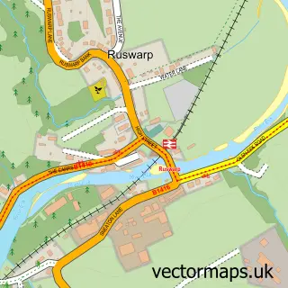
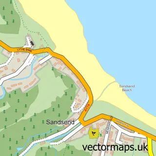
This Whitby street map is a detailed vector street map covering a 750m x 750m area. Select a larger area to create and download your own vector street map of Whitby.
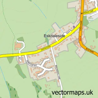
The 750-metre map sample for Whitby covers 237 mapped buildings and approximately 18.4 km of road detail, of which 60 named roads are named. The immediate area includes 1 railway station, 1 GP surgery within 2 miles, 36 pubs and 3 MOT stations within 2 miles. The wider area around Whitby features 24 tourism points of interest, 88 food and drink venues and 58 hotels. To create a larger or custom map of Whitby, the map builder lets you define your own coverage area and download editable SVG, PDF and PNG files.
Create a larger editable map of Whitby
Choose any area you need and generate a high-quality vector map instantly. Perfect for print, planning, design, business and personal use.

This Whitby street map in North Yorkshire is available as downloadable SVG, PDF and PNG map files, or as a printed map for planning, business, display, education, local information and design work. You can also create a larger custom map area using the map selector.
What this Whitby map sample shows
Whitby lies within Whitby Cp parish, part of Streonshalh ward in the North Yorkshire local authority area. The postcode geography for this area includes the YO postcode area, the YO22 postcode district and the YO22 4 postcode sector. Residents fall under the Nhs Humber And North Yorkshire Integrated Care Board for NHS services.
Local features near Whitby
Within 2 milesAmenities and services in and around Whitby.
Administrative and postcode information for Whitby
The local authority covering Whitby is North Yorkshire, within the county of North Yorkshire. The settlement lies within Streonshalh ward and Whitby Cp civil parish. The YO22 postcode district and YO22 4 postcode sector serve the immediate area. NHS provision in the area is delivered through York And Scarborough Teaching Hospitals Nhs Foundation Trust.
Nearby street map samples around Whitby

More street maps in North Yorkshire
750 metre map area coverage
Boundary, postcode and point of interest information for the 750m x 750m rectangle centred on this sample map.
Boundaries containing map centre
Constituency: Scarborough and Whitby Co Const
District: North Yorkshire
Icb: NHS Humber and North Yorkshire ICB
Parish: Whitby CP
Police Force: north yorkshire
Postcode District: YO21
Postcode Sector: YO21 1
Nearby boundaries intersecting sample
Postcode District: YO22
Postcode Sector: YO21 3, YO22 4
Postcode coverage
POI category counts
Hotel: 58
Holiday Rental Home: 47
Bed And Breakfast: 40
Pub: 37
Flowers And Gifts Shop: 29
Cottage: 28
Cafe: 25
Clothing Store: 19
Jewelry Store: 16
Antique Store: 15
Sample points of interest
- East Cliff View Whitby holiday apartment.
- Elizabeth House
- Grantley House
- Moby Dick
- Mount House Whitby
- Skerry Hall Farm B & B
- The Old Auction Rooms
- The Shipping Office
- The Town House
- M Wasley Chapman & Co
- Healing Vibrations
- Whitby Fishermans Amateur Rowing Club
Create a larger editable map of Whitby
This sample shows only a 750 metre area. To create a larger map of Whitby, use our map builder to choose your own coverage area, add titles and download editable SVG, PDF and PNG files.
Create a custom map of Whitby