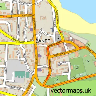
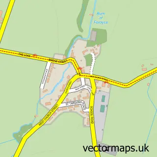
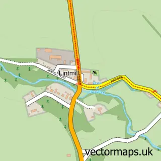
This Whitehills street map is a detailed vector street map covering a 750m x 750m area. Select a larger area to create and download your own vector street map of Whitehills.
The 750-metre map sample for Whitehills covers 350 mapped buildings and approximately 13.4 km of road detail, of which 23 named roads are named. The immediate area includes 1 pub and 1 MOT station within 2 miles. The wider area around Whitehills features 2 food and drink venues, 3 hotels and 1 campsite within 2 miles. To create a larger or custom map of Whitehills, the map builder lets you define your own coverage area and download editable SVG, PDF and PNG files.
Create a larger editable map of Whitehills
Choose any area you need and generate a high-quality vector map instantly. Perfect for print, planning, design, business and personal use.

This Whitehills street map in Banffshire is available as downloadable SVG, PDF and PNG map files, or as a printed map for planning, business, display, education, local information and design work. You can also create a larger custom map area using the map selector.
What this Whitehills map sample shows
Whitehills lies within Aberdeenshire parish, part of Banff And District ward in the Aberdeenshire local authority area. The postcode geography for this area includes the AB postcode area, the AB45 postcode district and the AB45 2 postcode sector. Local NHS services are provided through Grampian.
Local features near Whitehills
Within 2 milesAmenities and services in and around Whitehills.
Administrative and postcode information for Whitehills
Whitehills lies within Aberdeenshire parish, part of Banff And District ward in the Aberdeenshire local authority area. The postcode geography for this area includes the AB postcode area, the AB45 postcode district and the AB45 2 postcode sector. Local NHS services are provided through Grampian.
Nearby street map samples around Whitehills

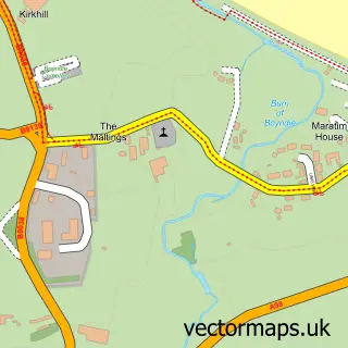
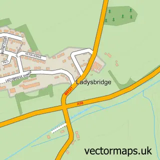
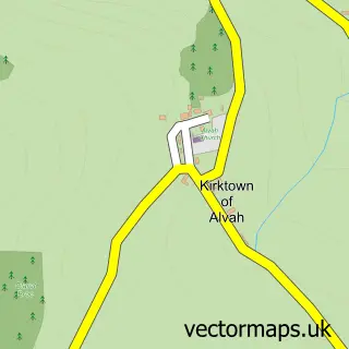
More street maps in Banffshire
750 metre map area coverage
Boundary, postcode and point of interest information for the 750m x 750m rectangle centred on this sample map.
Boundaries containing map centre
Constituency: Aberdeenshire North and Moray East Co Const
District: Aberdeenshire
Icb: Grampian
Postcode District: AB45
Postcode Sector: AB45 2
Ward: Banff and District Ward
Nearby boundaries intersecting sample
No additional intersecting boundaries found.
Postcode coverage
POI category counts
Hotel: 3
Beauty Salon: 2
Building Supply Store: 2
Church Cathedral: 2
Convenience Store: 2
Shipping Center: 2
Arts And Crafts: 1
Beverage Store: 1
Currency Exchange: 1
Education: 1
Sample points of interest
- Watergaw Ceramics
- Rebel at the Retreat
- The Retreat Hair & Beauty Whitehills
- The Cutty
- Breedon Boyne Bay Quarry — Aggregates & Ready-mixed concrete
- S&N Carle Ltd
- St. Brandon's Church Centre
- Whitehills Parish Church
- Premier
- Premier Premier Whitehills
- Post Office Travel Money
- Emily's Childminding
Create a larger editable map of Whitehills
This sample shows only a 750 metre area. To create a larger map of Whitehills, use our map builder to choose your own coverage area, add titles and download editable SVG, PDF and PNG files.
Create a custom map of Whitehills