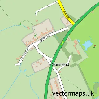
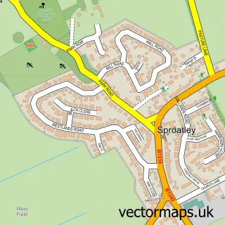
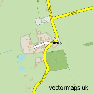
This Wyton street map is a detailed vector street map covering a 750m x 750m area. Select a larger area to create and download your own vector street map of Wyton.
The 750-metre map sample for Wyton covers 125 mapped buildings and approximately 4.4 km of road detail, of which 4 named roads are named. The immediate area includes 1 GP surgery within 2 miles and 2 MOT stations within 2 miles. The wider area around Wyton features 1 food and drink venue and 2 campsites within 2 miles. To create a larger or custom map of Wyton, the map builder lets you define your own coverage area and download editable SVG, PDF and PNG files.
Create a larger editable map of Wyton
Choose any area you need and generate a high-quality vector map instantly. Perfect for print, planning, design, business and personal use.

This Wyton street map in East Riding of Yorkshire is available as downloadable SVG, PDF and PNG map files, or as a printed map for planning, business, display, education, local information and design work. You can also create a larger custom map area using the map selector.
What this Wyton map sample shows
Wyton lies within Bilton Cp parish, part of Mid Holderness ward in the East Riding Of Yorkshire local authority area. The postcode geography for this area includes the HU postcode area, the HU11 postcode district and the HU11 4 postcode sector. Residents fall under the Nhs Humber And North Yorkshire Integrated Care Board for NHS services.
Local features near Wyton
Within 2 milesAmenities and services in and around Wyton.
Administrative and postcode information for Wyton
Wyton lies within Bilton Cp parish, part of Mid Holderness ward in the East Riding Of Yorkshire local authority area. The postcode geography for this area includes the HU postcode area, the HU11 postcode district and the HU11 4 postcode sector. Residents fall under the Nhs Humber And North Yorkshire Integrated Care Board for NHS services.
Nearby street map samples around Wyton

More street maps in East Riding of Yorkshire
750 metre map area coverage
Boundary, postcode and point of interest information for the 750m x 750m rectangle centred on this sample map.
Boundaries containing map centre
Constituency: Beverley and Holderness Co Const
District: East Riding of Yorkshire
Icb: NHS Humber and North Yorkshire ICB
Parish: Bilton CP
Police Force: humberside
Postcode District: HU11
Postcode Sector: HU11 4
Ward: Mid Holderness Ward
Nearby boundaries intersecting sample
No additional intersecting boundaries found.
Postcode coverage
POI category counts
Gas Station: 4
Korean Grocery Store: 2
Beauty Salon: 1
Coffee Shop: 1
Contractor: 1
Convenience Store: 1
Farm: 1
Fish And Chips Restaurant: 1
Laundromat: 1
Laundry Services: 1
Sample points of interest
- Askhair
- Costa Coffee
- Unique Paving and Resin Solutions
- Londis
- John Wrights Turkeys
- Bilton Fisheries
- BP
- Bilton Service Station
- SEWELL ON THE GO WYTONBAR
- Wyton Bar Service Station
- Post Office-Bilton
- Sewell on The go
Create a larger editable map of Wyton
This sample shows only a 750 metre area. To create a larger map of Wyton, use our map builder to choose your own coverage area, add titles and download editable SVG, PDF and PNG files.
Create a custom map of Wyton