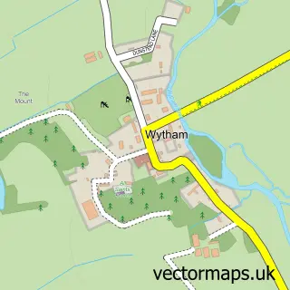
This Yarnton street map is a detailed vector street map covering a 750m x 750m area. Select a larger area to create and download your own vector street map of Yarnton.
The 750-metre map sample for Yarnton covers 410 mapped buildings and approximately 27.4 km of road detail, of which 20 named roads are named. The immediate area includes 1 school, 2 GP surgeries within 2 miles, 1 pub and 11 MOT stations within 2 miles. The wider area around Yarnton features 1 tourism point of interest and 2 food and drink venues. To create a larger or custom map of Yarnton, the map builder lets you define your own coverage area and download editable SVG, PDF and PNG files.
Create a larger editable map of Yarnton
Choose any area you need and generate a high-quality vector map instantly. Perfect for print, planning, design, business and personal use.

This Yarnton street map in Oxfordshire is available as downloadable SVG, PDF and PNG map files, or as a printed map for planning, business, display, education, local information and design work. You can also create a larger custom map area using the map selector.
What this Yarnton map sample shows
Yarnton lies within Yarnton Cp parish, part of Kidlington West ward in the Cherwell District local authority area. The postcode geography for this area includes the OX postcode area, the OX5 postcode district and the OX5 1 postcode sector. Residents fall under the Nhs Buckinghamshire, Oxfordshire And Berkshire West Integrated Care Board for NHS services.
Local features near Yarnton
Within 2 milesAmenities and services in and around Yarnton.
Administrative and postcode information for Yarnton
The local authority covering Yarnton is Cherwell District, within the county of Oxfordshire. The settlement lies within Kidlington West ward and Yarnton Cp civil parish. The OX5 postcode district and OX5 1 postcode sector serve the immediate area. NHS provision in the area is delivered through Oxford University Hospitals Nhs Foundation Trust.
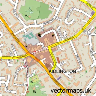
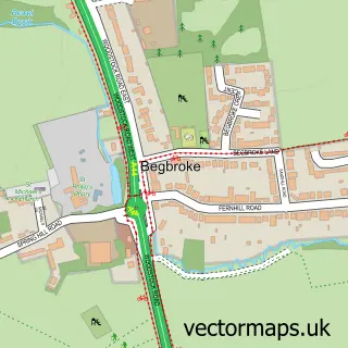
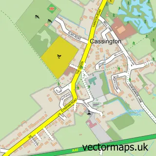
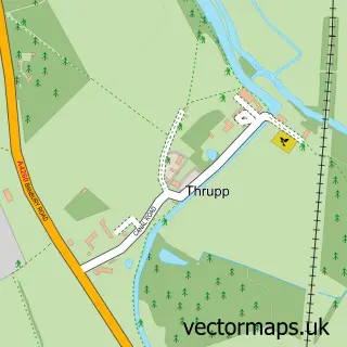
Nearby street map samples around Yarnton


More street maps in Oxfordshire
750 metre map area coverage
Boundary, postcode and point of interest information for the 750m x 750m rectangle centred on this sample map.
Boundaries containing map centre
Constituency: Bicester and Woodstock Co Const
County: Oxfordshire County
District: Cherwell District
Icb: NHS Thames Valley ICB
Parish: Yarnton CP
Police Force: thames valley
Postcode District: OX5
Postcode Sector: OX5 1
Ward: Kidlington West Ward
Nearby boundaries intersecting sample
No additional intersecting boundaries found.
Postcode coverage
POI category counts
Convenience Store: 4
Gas Station: 4
Elementary School: 2
Post Office: 2
Rental Kiosks: 2
Scout Hall: 2
Atms: 1
Beauty And Spa: 1
Beauty Salon: 1
Business Management Services: 1
Sample points of interest
- Yarnton Service Station (ERF SWAP)
- DermElite Beauty
- Irena's Beauty Room
- The Internet Lab
- Oxford Van Centre
- BP Car Wash
- Hugh Tierney
- Wild Bean Cafe
- Yarnton Village Hall
- Yarnton Scout Group
- Budgens
- Fraser's Budgens of Yarnton
Create a larger editable map of Yarnton
This sample shows only a 750 metre area. To create a larger map of Yarnton, use our map builder to choose your own coverage area, add titles and download editable SVG, PDF and PNG files.
Create a custom map of Yarnton