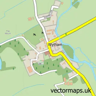
This Cassington street map is a detailed vector street map covering a 750m x 750m area. Select a larger area to create and download your own vector street map of Cassington.
The 750-metre map sample for Cassington covers 227 mapped buildings and approximately 15.2 km of road detail, of which 17 named roads are named. The immediate area includes 1 school, 1 GP surgery within 2 miles, 2 pubs and 3 MOT stations within 2 miles. The wider area around Cassington features 2 food and drink venues. To create a larger or custom map of Cassington, the map builder lets you define your own coverage area and download editable SVG, PDF and PNG files.
Create a larger editable map of Cassington
Choose any area you need and generate a high-quality vector map instantly. Perfect for print, planning, design, business and personal use.

This Cassington street map in Oxfordshire is available as downloadable SVG, PDF and PNG map files, or as a printed map for planning, business, display, education, local information and design work. You can also create a larger custom map area using the map selector.
What this Cassington map sample shows
Cassington lies within Cassington Cp parish, part of Eynsham And Cassington ward in the West Oxfordshire District local authority area. The postcode geography for this area includes the OX postcode area, the OX29 postcode district and the OX29 4 postcode sector. Residents fall under the Nhs Buckinghamshire, Oxfordshire And Berkshire West Integrated Care Board for NHS services.
Local features near Cassington
Within 2 milesAmenities and services in and around Cassington.
Administrative and postcode information for Cassington
Cassington lies within Cassington Cp parish, part of Eynsham And Cassington ward in the West Oxfordshire District local authority area. The postcode geography for this area includes the OX postcode area, the OX29 postcode district and the OX29 4 postcode sector. Residents fall under the Nhs Buckinghamshire, Oxfordshire And Berkshire West Integrated Care Board for NHS services.
Nearby street map samples around Cassington


More street maps in Oxfordshire
750 metre map area coverage
Boundary, postcode and point of interest information for the 750m x 750m rectangle centred on this sample map.
Boundaries containing map centre
Constituency: Bicester and Woodstock Co Const
County: Oxfordshire County
District: West Oxfordshire District
Icb: NHS Thames Valley ICB
Parish: Cassington CP
Police Force: thames valley
Postcode District: OX29
Postcode Sector: OX29 4
Ward: Eynsham and Cassington Ward
Nearby boundaries intersecting sample
No additional intersecting boundaries found.
Postcode coverage
POI category counts
Building Supply Store: 4
Automotive Repair: 2
Community Center: 2
Elementary School: 2
Professional Services: 2
Pub: 2
Advertising Agency: 1
Anglican Church: 1
Art Gallery: 1
Assisted Living Facility: 1
Sample points of interest
- Kevin Hinton Design
- Cassington: St Peter
- Hemingway Art
- Longlands Nursing Home
- Refined-shine
- Extreme Rally
- Rygor Commercial
- Lumos Electrical
- Oxford Salvage
- Snell Holdings
- TCF Construction
- Contact Consulting
Create a larger editable map of Cassington
This sample shows only a 750 metre area. To create a larger map of Cassington, use our map builder to choose your own coverage area, add titles and download editable SVG, PDF and PNG files.
Create a custom map of Cassington