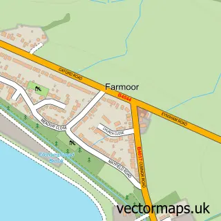
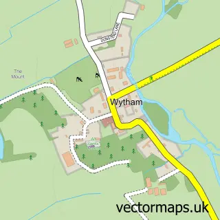
This Eynsham street map is a detailed vector street map covering a 750m x 750m area. Select a larger area to create and download your own vector street map of Eynsham.
The 750-metre map sample for Eynsham covers 461 mapped buildings and approximately 34.6 km of road detail, of which 37 named roads are named. The immediate area includes 1 school, 1 GP surgery, 2 pubs and 1 MOT station, with 4 within 2 miles. The wider area around Eynsham features 10 food and drink venues and 1 hotel. To create a larger or custom map of Eynsham, the map builder lets you define your own coverage area and download editable SVG, PDF and PNG files.
Create a larger editable map of Eynsham
Choose any area you need and generate a high-quality vector map instantly. Perfect for print, planning, design, business and personal use.

This Eynsham street map in Oxfordshire is available as downloadable SVG, PDF and PNG map files, or as a printed map for planning, business, display, education, local information and design work. You can also create a larger custom map area using the map selector.
What this Eynsham map sample shows
Eynsham lies within Eynsham Cp parish, part of Eynsham And Cassington ward in the West Oxfordshire District local authority area. The postcode geography for this area includes the OX postcode area, the OX29 postcode district and the OX29 4 postcode sector. Residents fall under the Nhs Buckinghamshire, Oxfordshire And Berkshire West Integrated Care Board for NHS services.
Local features near Eynsham
Within 2 milesAmenities and services in and around Eynsham.
Administrative and postcode information for Eynsham
Eynsham lies within Eynsham Cp parish, part of Eynsham And Cassington ward in the West Oxfordshire District local authority area. The postcode geography for this area includes the OX postcode area, the OX29 postcode district and the OX29 4 postcode sector. Residents fall under the Nhs Buckinghamshire, Oxfordshire And Berkshire West Integrated Care Board for NHS services.
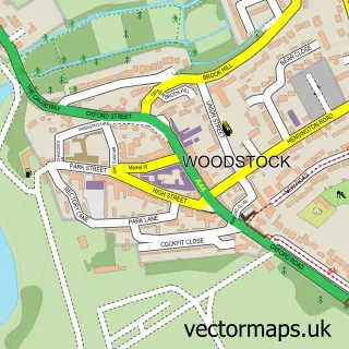
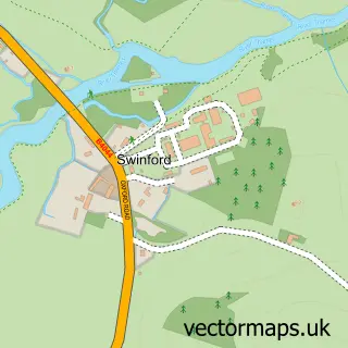
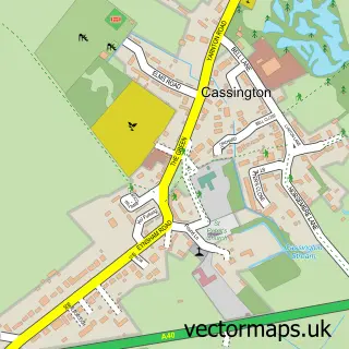
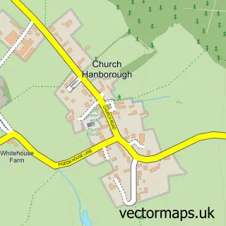
Nearby street map samples around Eynsham

More street maps in Oxfordshire
750 metre map area coverage
Boundary, postcode and point of interest information for the 750m x 750m rectangle centred on this sample map.
Boundaries containing map centre
Constituency: Bicester and Woodstock Co Const
County: Oxfordshire County
District: West Oxfordshire District
Icb: NHS Thames Valley ICB
Parish: Eynsham CP
Police Force: thames valley
Postcode District: OX29
Postcode Sector: OX29 4
Ward: Eynsham and Cassington Ward
Nearby boundaries intersecting sample
No additional intersecting boundaries found.
Postcode coverage
POI category counts
Coffee Shop: 4
Cafe: 3
Gas Station: 3
Hair Salon: 3
Korean Grocery Store: 3
Veterinarian: 3
Building Supply Store: 2
Chiropractor: 2
Doctor: 2
Equestrian Facility: 2
Sample points of interest
- Eynsham Village
- Talmage's Domestic Appliances
- Oxford Classics
- Barclays ATM
- Shire Tyre Services
- Blissful Bites
- Body Talk Hair and Beauty
- Clarify Interiors
- Evenlode Plastering Ltd
- Kingswell
- Eynsham Emporium
- Kingsley Cafe
Create a larger editable map of Eynsham
This sample shows only a 750 metre area. To create a larger map of Eynsham, use our map builder to choose your own coverage area, add titles and download editable SVG, PDF and PNG files.
Create a custom map of Eynsham