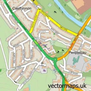
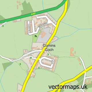
This Aberystwyth street map is a detailed vector street map covering a 750m x 750m area. Select a larger area to create and download your own vector street map of Aberystwyth.
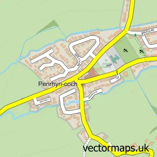
The 750-metre map sample for Aberystwyth covers 224 mapped buildings and approximately 23.8 km of road detail, of which 69 named roads are named. The immediate area includes 1 railway station, 21 pubs and 1 MOT station, with 5 within 2 miles. The wider area around Aberystwyth features 12 tourism points of interest, 58 food and drink venues and 15 hotels. To create a larger or custom map of Aberystwyth, the map builder lets you define your own coverage area and download editable SVG, PDF and PNG files.
Create a larger editable map of Aberystwyth
Choose any area you need and generate a high-quality vector map instantly. Perfect for print, planning, design, business and personal use.

This Aberystwyth street map in Dyfed is available as downloadable SVG, PDF and PNG map files, or as a printed map for planning, business, display, education, local information and design work. You can also create a larger custom map area using the map selector.
What this Aberystwyth map sample shows
Aberystwyth lies within Aberystwyth Community parish, part of Aberystwyth Gogledd/North ward in the Sir Ceredigion - Ceredigion local authority area. The postcode geography for this area includes the SY postcode area, the SY23 postcode district and the SY23 2 postcode sector. Residents fall under the Hywel Dda University Health Board for NHS services.
Local features near Aberystwyth
Within 2 milesAmenities and services in and around Aberystwyth.
Administrative and postcode information for Aberystwyth
Aberystwyth lies within Aberystwyth Community parish, part of Aberystwyth Gogledd/North ward in the Sir Ceredigion - Ceredigion local authority area. The postcode geography for this area includes the SY postcode area, the SY23 postcode district and the SY23 2 postcode sector. Residents fall under the Hywel Dda University Health Board for NHS services.
Nearby street map samples around Aberystwyth

More street maps in Dyfed
750 metre map area coverage
Boundary, postcode and point of interest information for the 750m x 750m rectangle centred on this sample map.
Boundaries containing map centre
Constituency: Ceredigion Preseli Co Const
District: Sir Ceredigion - Ceredigion
Icb: Hywel Dda
Parish: Aberystwyth Community
Police Force: dyfed-powys
Postcode District: SY23
Postcode Sector: SY23 1
Nearby boundaries intersecting sample
Postcode Sector: SY23 2
Postcode coverage
POI category counts
Clothing Store: 22
Pub: 21
Beauty Salon: 18
Hotel: 15
Restaurant: 15
Hair Salon: 14
Bookstore: 12
Cafe: 12
Charity Organization: 12
Community Services Non Profits: 12
Sample points of interest
- 25A Bridge Street
- 52 Cambrian Homestay
- Quay West, New Quay
- Davies Lewis Baker Accountants
- Francis Gray Ltd
- Geraint Dafis
- Mid Wales Paragliding Centre
- Cambrian Osteopaths
- Crystal Fountain
- Jan Batty Rshom
- North Parade Osteopathic Clinic
- Holy Trinity Church
Create a larger editable map of Aberystwyth
This sample shows only a 750 metre area. To create a larger map of Aberystwyth, use our map builder to choose your own coverage area, add titles and download editable SVG, PDF and PNG files.
Create a custom map of Aberystwyth