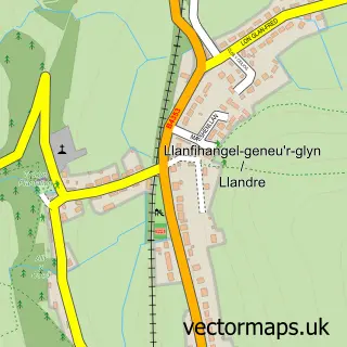
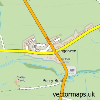
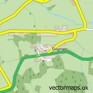
This Penrhyn-coch street map is a detailed vector street map covering a 750m x 750m area. Select a larger area to create and download your own vector street map of Penrhyn-coch.
The 750-metre map sample for Penrhyn-coch covers 229 mapped buildings and approximately 10.1 km of road detail, of which 5 named roads are named. The immediate area includes 1 school and 1 MOT station within 2 miles. To create a larger or custom map of Penrhyn-coch, the map builder lets you define your own coverage area and download editable SVG, PDF and PNG files.
Create a larger editable map of Penrhyn-coch
Choose any area you need and generate a high-quality vector map instantly. Perfect for print, planning, design, business and personal use.

This Penrhyn-coch street map in Dyfed is available as downloadable SVG, PDF and PNG map files, or as a printed map for planning, business, display, education, local information and design work. You can also create a larger custom map area using the map selector.
What this Penrhyn-coch map sample shows
Penrhyn-coch lies within Trefeurig Community parish, part of Trefeurig ward in the Sir Ceredigion - Ceredigion local authority area. The postcode geography for this area includes the SY postcode area, the SY23 postcode district and the SY23 3 postcode sector. Residents fall under the Hywel Dda University Health Board for NHS services.
Local features near Penrhyn-coch
Within 2 milesAmenities and services in and around Penrhyn-coch.
Administrative and postcode information for Penrhyn-coch
The local authority covering Penrhyn-coch is Sir Ceredigion - Ceredigion, within the county of Dyfed. The settlement lies within Trefeurig ward and Trefeurig Community civil parish. The SY23 postcode district and SY23 3 postcode sector serve the immediate area. NHS provision in the area is delivered through Hywel Dda University Health Board.
Nearby street map samples around Penrhyn-coch

More street maps in Dyfed
750 metre map area coverage
Boundary, postcode and point of interest information for the 750m x 750m rectangle centred on this sample map.
Boundaries containing map centre
Constituency: Ceredigion Preseli Co Const
District: Sir Ceredigion - Ceredigion
Icb: Hywel Dda
Parish: Trefeurig Community
Police Force: dyfed-powys
Postcode District: SY23
Postcode Sector: SY23 3
Nearby boundaries intersecting sample
No additional intersecting boundaries found.
Postcode coverage
POI category counts
Convenience Store: 3
Gas Station: 2
Ambulance And Ems Services: 1
Anglican Church: 1
Construction Services: 1
Contractor: 1
Education: 1
Funeral Services And Cemeteries: 1
Korean Grocery Store: 1
Professional Services: 1
Sample points of interest
- Promove UK
- Eglwys Sant Ioan
- C B S Mid Wales Ltd
- CBS Mid Wales
- Nisa Local Tymawr
- Premier
- Premier Siop Penrhyncoch
- Ysgol Penrhyncoch
- D J Evans Funeral Directors
- BP
- TYMAWR FILLING STATION
- Penrhyncoch Post Office
Create a larger editable map of Penrhyn-coch
This sample shows only a 750 metre area. To create a larger map of Penrhyn-coch, use our map builder to choose your own coverage area, add titles and download editable SVG, PDF and PNG files.
Create a custom map of Penrhyn-coch