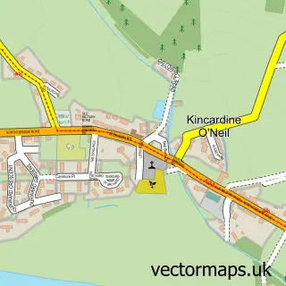
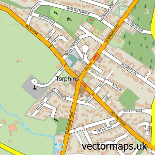
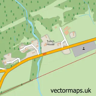
This Aboyne street map is a detailed vector street map covering a 750m x 750m area. Select a larger area to create and download your own vector street map of Aboyne.
The 750-metre map sample for Aboyne covers 84 mapped buildings and approximately 9.4 km of road detail, of which 15 named roads are named. The immediate area includes 1 GP surgery within 2 miles and 2 MOT stations within 2 miles. The wider area around Aboyne features 2 tourism points of interest, 4 food and drink venues and 3 hotels. To create a larger or custom map of Aboyne, the map builder lets you define your own coverage area and download editable SVG, PDF and PNG files.
Create a larger editable map of Aboyne
Choose any area you need and generate a high-quality vector map instantly. Perfect for print, planning, design, business and personal use.

This Aboyne street map in Aberdeenshire is available as downloadable SVG, PDF and PNG map files, or as a printed map for planning, business, display, education, local information and design work. You can also create a larger custom map area using the map selector.
What this Aboyne map sample shows
Aboyne lies within Aberdeenshire parish, part of Aboyne, Upper Deeside And Donside ward in the Aberdeenshire local authority area. The postcode geography for this area includes the AB postcode area, the AB34 postcode district and the AB34 5 postcode sector. Residents fall under the Grampian for NHS services.
Local features near Aboyne
Within 2 milesAmenities and services in and around Aboyne.
Administrative and postcode information for Aboyne
Aboyne lies within Aberdeenshire parish, part of Aboyne, Upper Deeside And Donside ward in the Aberdeenshire local authority area. The postcode geography for this area includes the AB postcode area, the AB34 postcode district and the AB34 5 postcode sector. Residents fall under the Grampian for NHS services.
Nearby street map samples around Aboyne

More street maps in Aberdeenshire
750 metre map area coverage
Boundary, postcode and point of interest information for the 750m x 750m rectangle centred on this sample map.
Boundaries containing map centre
Constituency: West Aberdeenshire and Kincardine Co Const
District: Aberdeenshire
Icb: Grampian
Postcode District: AB34
Postcode Sector: AB34 5
Ward: Aboyne, Upper Deeside and Donside Ward
Nearby boundaries intersecting sample
No additional intersecting boundaries found.
Postcode coverage
POI category counts
Hair Salon: 3
Hotel: 3
Architectural Designer: 2
Art Gallery: 2
Banks: 2
Beauty Salon: 2
Building Supply Store: 2
Cafe: 2
Coffee Shop: 2
Convenience Store: 2
Sample points of interest
- Johnston Carmichael
- Kinkead Consulting
- Ballaterach Farm & Holiday Cottage
- DWR Architecture
- JH Architectural Ltd
- Artaboyne
- The Butterworth Gallery
- The Royal Kashmir Tandoori
- The Cooperative Food (BF) Aboyne
- Courie Courie Bakery
- Clydesdale Bank
- TSB Bank
Create a larger editable map of Aboyne
This sample shows only a 750 metre area. To create a larger map of Aboyne, use our map builder to choose your own coverage area, add titles and download editable SVG, PDF and PNG files.
Create a custom map of Aboyne