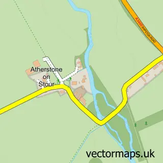
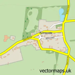
This Alderminster street map is a detailed vector street map covering a 750m x 750m area. Select a larger area to create and download your own vector street map of Alderminster.
The 750-metre map sample for Alderminster covers 133 mapped buildings and approximately 13.0 km of road detail, of which 8 named roads are named. The immediate area includes 2 pubs and 1 MOT station. The wider area around Alderminster features 3 food and drink venues. To create a larger or custom map of Alderminster, the map builder lets you define your own coverage area and download editable SVG, PDF and PNG files.
Create a larger editable map of Alderminster
Choose any area you need and generate a high-quality vector map instantly. Perfect for print, planning, design, business and personal use.

This Alderminster street map in Warwickshire is available as downloadable SVG, PDF and PNG map files, or as a printed map for planning, business, display, education, local information and design work. You can also create a larger custom map area using the map selector.
What this Alderminster map sample shows
Alderminster lies within Alderminster Cp parish, part of Ettington ward in the Stratford-On-Avon District local authority area. The postcode geography for this area includes the CV postcode area, the CV37 postcode district and the CV37 8 postcode sector. Residents fall under the Nhs Coventry And Warwickshire Integrated Care Board for NHS services.
Local features near Alderminster
Within 2 milesAmenities and services in and around Alderminster.
Administrative and postcode information for Alderminster
Alderminster lies within Alderminster Cp parish, part of Ettington ward in the Stratford-On-Avon District local authority area. The postcode geography for this area includes the CV postcode area, the CV37 postcode district and the CV37 8 postcode sector. Residents fall under the Nhs Coventry And Warwickshire Integrated Care Board for NHS services.
Nearby street map samples around Alderminster


More street maps in Warwickshire
750 metre map area coverage
Boundary, postcode and point of interest information for the 750m x 750m rectangle centred on this sample map.
Boundaries containing map centre
Constituency: Stratford-on-Avon Co Const
County: Warwickshire County
District: Stratford-on-Avon District
Icb: NHS Coventry and Warwickshire ICB
Parish: Alderminster CP
Police Force: warwickshire
Postcode District: CV37
Postcode Sector: CV37 8
Ward: Quinton Ward
Nearby boundaries intersecting sample
Parish: Whitchurch CP
Postcode coverage
POI category counts
Anglican Church: 2
Laundry Services: 2
Pub: 2
Automotive Repair: 1
Building Supply Store: 1
Bus Station: 1
Business Consulting: 1
Financial Service: 1
Industrial Equipment: 1
Massage: 1
Sample points of interest
- Alderminster - St. Mary and Holy Cross
- St Mary's, Whitchurch
- J H Thorp
- Twist Interiors
- Bell
- Precision Cem
- Cogent Financial Services
- Screeduct
- Carpet Cleaning Prince
- Lulu's Lovely Laundry
- Hands on Hot Stone Massage
- Hands on Hot Stone Massage
Create a larger editable map of Alderminster
This sample shows only a 750 metre area. To create a larger map of Alderminster, use our map builder to choose your own coverage area, add titles and download editable SVG, PDF and PNG files.
Create a custom map of Alderminster