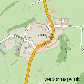
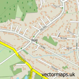
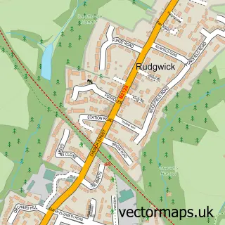
This Alfold Bars street map is a detailed vector street map covering a 750m x 750m area. Select a larger area to create and download your own vector street map of Alfold Bars.
The 750-metre map sample for Alfold Bars covers 93 mapped buildings and approximately 5.1 km of road detail, of which 5 named roads are named. The immediate area includes 1 GP surgery within 2 miles, 3 pubs and 2 MOT stations within 2 miles. The wider area around Alfold Bars features 3 food and drink venues. To create a larger or custom map of Alfold Bars, the map builder lets you define your own coverage area and download editable SVG, PDF and PNG files.
Create a larger editable map of Alfold Bars
Choose any area you need and generate a high-quality vector map instantly. Perfect for print, planning, design, business and personal use.

This Alfold Bars street map in West Sussex is available as downloadable SVG, PDF and PNG map files, or as a printed map for planning, business, display, education, local information and design work. You can also create a larger custom map area using the map selector.
What this Alfold Bars map sample shows
Alfold Bars lies within Alfold Cp parish, part of Alfold, Cranleigh Rural And Ellens Green ward in the Waverley District (B) local authority area. The postcode geography for this area includes the GU postcode area, the GU6 postcode district and the GU6 8 postcode sector. Residents fall under the Nhs Surrey Heartlands Integrated Care Board for NHS services.
Local features near Alfold Bars
Within 2 milesAmenities and services in and around Alfold Bars.
Administrative and postcode information for Alfold Bars
Alfold Bars lies within Alfold Cp parish, part of Alfold, Cranleigh Rural And Ellens Green ward in the Waverley District (B) local authority area. The postcode geography for this area includes the GU postcode area, the GU6 postcode district and the GU6 8 postcode sector. Residents fall under the Nhs Surrey Heartlands Integrated Care Board for NHS services.
Nearby street map samples around Alfold Bars

More street maps in West Sussex
750 metre map area coverage
Boundary, postcode and point of interest information for the 750m x 750m rectangle centred on this sample map.
Boundaries containing map centre
Constituency: Arundel and South Downs Co Const
County: West Sussex County
District: Chichester District
Icb: NHS Surrey and Sussex ICB
Parish: Loxwood CP
Police Force: sussex
Postcode District: RH14
Postcode Sector: RH14 0
Ward: Loxwood Ward
Nearby boundaries intersecting sample
Constituency: Godalming and Ash Co Const
County: Surrey County
District: Waverley District (B)
Parish: Alfold CP
Police Force: surrey
Postcode District: RH12
Postcode Sector: RH12 3
Ward: Alfold, Dunsfold & Hascombe Ward
Postcode coverage
POI category counts
Pub: 3
Building Supply Store: 1
Car Dealer: 1
Corporate Entertainment Services: 1
Gardener: 1
Sporting Goods: 1
Used Car Dealer: 1
Sample points of interest
- Shower Power
- Church's Performance Cars
- Proshot Simulation
- MW Hedges Garden Maintenance Services
- Sir Roger Tichbourne
- The Sir Roger Tichborne
- The Sir Roger Tichborne
- Ifield Park Saddlery & Animal Centre
- Church's Performance Cars
Create a larger editable map of Alfold Bars
This sample shows only a 750 metre area. To create a larger map of Alfold Bars, use our map builder to choose your own coverage area, add titles and download editable SVG, PDF and PNG files.
Create a custom map of Alfold Bars