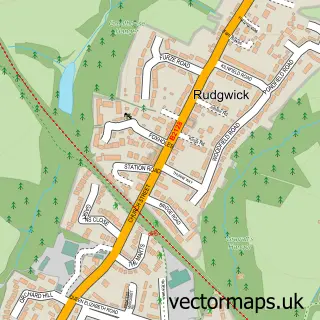
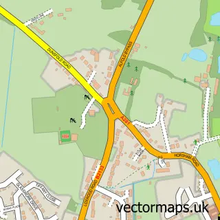
This Bucks Green street map is a detailed vector street map covering a 750m x 750m area. Select a larger area to create and download your own vector street map of Bucks Green.
The 750-metre map sample for Bucks Green covers 110 mapped buildings and approximately 6.8 km of road detail, of which 4 named roads are named. The immediate area includes 1 GP surgery within 2 miles, 1 pub and 1 MOT station. The wider area around Bucks Green features 1 tourism point of interest and 2 food and drink venues. To create a larger or custom map of Bucks Green, the map builder lets you define your own coverage area and download editable SVG, PDF and PNG files.
Create a larger editable map of Bucks Green
Choose any area you need and generate a high-quality vector map instantly. Perfect for print, planning, design, business and personal use.

This Bucks Green street map in West Sussex is available as downloadable SVG, PDF and PNG map files, or as a printed map for planning, business, display, education, local information and design work. You can also create a larger custom map area using the map selector.
What this Bucks Green map sample shows
Bucks Green lies within Rudgwick Cp parish, part of Rudgwick ward in the Horsham District local authority area. The postcode geography for this area includes the RH postcode area, the RH12 postcode district and the RH12 3 postcode sector. Residents fall under the Nhs Sussex Integrated Care Board for NHS services.
Local features near Bucks Green
Within 2 milesAmenities and services in and around Bucks Green.
Administrative and postcode information for Bucks Green
The local authority covering Bucks Green is Horsham District, within the county of West Sussex. The settlement lies within Rudgwick ward and Rudgwick Cp civil parish. The RH12 postcode district and RH12 3 postcode sector serve the immediate area. NHS provision in the area is delivered through Royal Surrey County Hospital Nhs Foundation Trust.
Nearby street map samples around Bucks Green
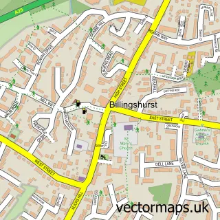

More street maps in West Sussex
750 metre map area coverage
Boundary, postcode and point of interest information for the 750m x 750m rectangle centred on this sample map.
Boundaries containing map centre
Constituency: Horsham Co Const
County: West Sussex County
District: Horsham District
Icb: NHS Surrey and Sussex ICB
Parish: Rudgwick CP
Police Force: sussex
Postcode District: RH12
Postcode Sector: RH12 3
Ward: Rudgwick Ward
Nearby boundaries intersecting sample
No additional intersecting boundaries found.
Postcode coverage
POI category counts
Automotive Repair: 2
Furniture Store: 2
Sports Club And League: 2
Appliance Manufacturer: 1
Auto Parts And Supply Store: 1
Building Supply Store: 1
Business Management Services: 1
Car Dealer: 1
Coffee Shop: 1
Community Center: 1
Sample points of interest
- Diva Lighting Ltd
- Hardings Motorworks
- Rudgwick Garage
- Rudgwick Garage
- Nortons Gardens
- Vicky Nice Interiors
- James Paul Car Sales
- Apple Tree Cafe
- Rudgwick Village Hall
- Highlife Conference & Incentive
- TMS Electrical Contractors
- The Sindy Bond
Create a larger editable map of Bucks Green
This sample shows only a 750 metre area. To create a larger map of Bucks Green, use our map builder to choose your own coverage area, add titles and download editable SVG, PDF and PNG files.
Create a custom map of Bucks Green