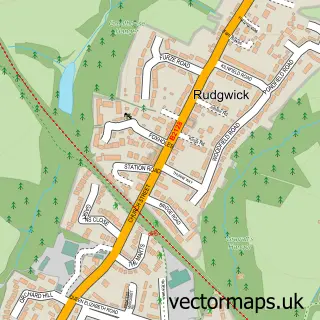
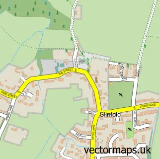
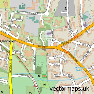
This Cox Green street map is a detailed vector street map covering a 750m x 750m area. Select a larger area to create and download your own vector street map of Cox Green.
The 750-metre map sample for Cox Green covers 80 mapped buildings and approximately 8.0 km of road detail, of which 3 named roads are named. The immediate area includes 1 GP surgery within 2 miles and 1 MOT station within 2 miles. To create a larger or custom map of Cox Green, the map builder lets you define your own coverage area and download editable SVG, PDF and PNG files.
Create a larger editable map of Cox Green
Choose any area you need and generate a high-quality vector map instantly. Perfect for print, planning, design, business and personal use.

This Cox Green street map in West Sussex is available as downloadable SVG, PDF and PNG map files, or as a printed map for planning, business, display, education, local information and design work. You can also create a larger custom map area using the map selector.
What this Cox Green map sample shows
Cox Green lies within Rudgwick Cp parish, part of Rudgwick ward in the Horsham District local authority area. The postcode geography for this area includes the RH postcode area, the RH12 postcode district and the RH12 3 postcode sector. Residents fall under the Nhs Sussex Integrated Care Board for NHS services.
Local features near Cox Green
Within 2 milesAmenities and services in and around Cox Green.
Administrative and postcode information for Cox Green
The local authority covering Cox Green is Horsham District, within the county of West Sussex. The settlement lies within Rudgwick ward and Rudgwick Cp civil parish. The RH12 postcode district and RH12 3 postcode sector serve the immediate area. NHS provision in the area is delivered through Royal Surrey County Hospital Nhs Foundation Trust.
Nearby street map samples around Cox Green

More street maps in West Sussex
750 metre map area coverage
Boundary, postcode and point of interest information for the 750m x 750m rectangle centred on this sample map.
Boundaries containing map centre
Constituency: Godalming and Ash Co Const
County: Surrey County
District: Waverley District (B)
Icb: NHS Surrey and Sussex ICB
Postcode District: RH12
Postcode Sector: RH12 3
Nearby boundaries intersecting sample
Constituency: Horsham Co Const
County: West Sussex County
District: Horsham District
Parish: Ewhurst CP, Rudgwick CP
Police Force: surrey, sussex
Ward: Ewhurst & Ellens Green Ward, Rudgwick Ward
Postcode coverage
POI category counts
Arts And Entertainment: 1
Elementary School: 1
Forestry Service: 1
Sample points of interest
- 600 Racing Europe
- Balcombe CE Primary School
- Westbrook Agricultural Supplies
Create a larger editable map of Cox Green
This sample shows only a 750 metre area. To create a larger map of Cox Green, use our map builder to choose your own coverage area, add titles and download editable SVG, PDF and PNG files.
Create a custom map of Cox Green