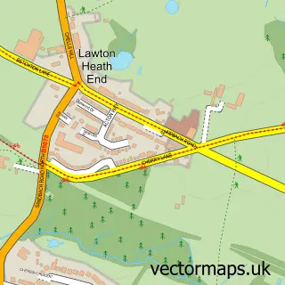
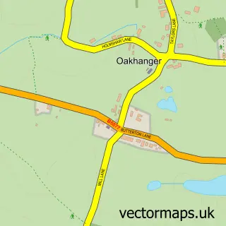
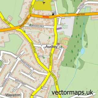
This Alsager street map is a detailed vector street map covering a 750m x 750m area. Select a larger area to create and download your own vector street map of Alsager.
The 750-metre map sample for Alsager covers 461 mapped buildings and approximately 16.3 km of road detail, of which 30 named roads are named. The immediate area includes 1 school, 2 GP surgeries, 3 pubs and 1 MOT station, with 3 within 2 miles. The wider area around Alsager features 2 tourism points of interest and 8 food and drink venues. To create a larger or custom map of Alsager, the map builder lets you define your own coverage area and download editable SVG, PDF and PNG files.
Create a larger editable map of Alsager
Choose any area you need and generate a high-quality vector map instantly. Perfect for print, planning, design, business and personal use.

This Alsager street map in Cheshire is available as downloadable SVG, PDF and PNG map files, or as a printed map for planning, business, display, education, local information and design work. You can also create a larger custom map area using the map selector.
What this Alsager map sample shows
Alsager lies within Alsager Cp parish, part of Alsager ward in the Cheshire East (B) local authority area. The postcode geography for this area includes the ST postcode area, the ST7 postcode district and the ST7 2 postcode sector. Residents fall under the Nhs Cheshire And Merseyside Integrated Care Board for NHS services.
Local features near Alsager
Within 2 milesAmenities and services in and around Alsager.
Administrative and postcode information for Alsager
Alsager lies within Alsager Cp parish, part of Alsager ward in the Cheshire East (B) local authority area. The postcode geography for this area includes the ST postcode area, the ST7 postcode district and the ST7 2 postcode sector. Residents fall under the Nhs Cheshire And Merseyside Integrated Care Board for NHS services.
Nearby street map samples around Alsager

More street maps in Cheshire
750 metre map area coverage
Boundary, postcode and point of interest information for the 750m x 750m rectangle centred on this sample map.
Boundaries containing map centre
Constituency: Congleton Co Const
District: Cheshire East (B)
Icb: NHS Cheshire and Merseyside ICB
Parish: Alsager CP
Police Force: cheshire
Postcode District: ST7
Postcode Sector: ST7 2
Ward: Alsager Ward
Nearby boundaries intersecting sample
No additional intersecting boundaries found.
Postcode coverage
POI category counts
Hair Salon: 9
Beauty Salon: 8
Banks: 6
Bar: 4
Church Cathedral: 4
Pharmacy: 4
Real Estate Agent: 4
Automotive Repair: 3
Charity Organization: 3
Cocktail Bar: 3
Sample points of interest
- Marshall Accountancy Ltd
- St Mary Magdalene
- Sue Ryder Care Alsager Charity Shops
- Beading Amazing
- A Banks Motor Engineers
- T B E Motor Services Ltd
- TBE Motor Services
- Alsager Bakehouse
- Chatwins
- Alsager Banking Hub
- Banking Hub
- Barclays
Create a larger editable map of Alsager
This sample shows only a 750 metre area. To create a larger map of Alsager, use our map builder to choose your own coverage area, add titles and download editable SVG, PDF and PNG files.
Create a custom map of Alsager