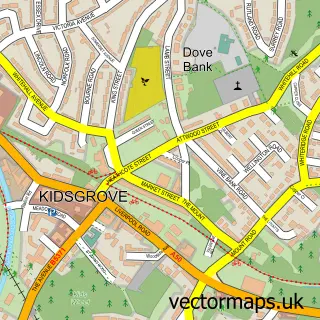
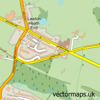
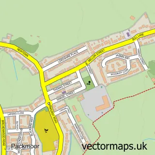
This Talke street map is a detailed vector street map covering a 750m x 750m area. Select a larger area to create and download your own vector street map of Talke.
The 750-metre map sample for Talke covers 151 mapped buildings and approximately 10.1 km of road detail, of which 11 named roads are named. The immediate area includes 5 GP surgeries within 2 miles and 6 MOT stations within 2 miles. To create a larger or custom map of Talke, the map builder lets you define your own coverage area and download editable SVG, PDF and PNG files.
Create a larger editable map of Talke
Choose any area you need and generate a high-quality vector map instantly. Perfect for print, planning, design, business and personal use.

This Talke street map in Staffordshire is available as downloadable SVG, PDF and PNG map files, or as a printed map for planning, business, display, education, local information and design work. You can also create a larger custom map area using the map selector.
What this Talke map sample shows
Talke lies within Kidsgrove Cp parish, part of Talke & Butt Lane ward in the Newcastle-Under-Lyme District (B) local authority area. The postcode geography for this area includes the ST postcode area, the ST7 postcode district and the ST7 1 postcode sector. Residents fall under the Nhs Staffordshire And Stoke-On-Trent Integrated Care Board for NHS services.
Local features near Talke
Within 2 milesAmenities and services in and around Talke.
Administrative and postcode information for Talke
The local authority covering Talke is Newcastle-Under-Lyme District (B), within the county of Staffordshire. The settlement lies within Talke & Butt Lane ward and Kidsgrove Cp civil parish. The ST7 postcode district and ST7 1 postcode sector serve the immediate area. NHS provision in the area is delivered through University Hospitals Of North Midlands Nhs Trust.
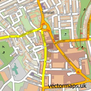
Nearby street map samples around Talke

More street maps in Staffordshire
750 metre map area coverage
Boundary, postcode and point of interest information for the 750m x 750m rectangle centred on this sample map.
Boundaries containing map centre
Constituency: Stoke-on-Trent North Boro Const
County: Staffordshire County
District: Newcastle-under-Lyme District (B)
Icb: NHS Staffordshire and Stoke-on-Trent ICB
Parish: Kidsgrove CP
Police Force: staffordshire
Postcode District: ST7
Postcode Sector: ST7 1
Ward: Talke & Butt Lane Ward
Nearby boundaries intersecting sample
Constituency: Congleton Co Const
Icb: NHS Cheshire and Merseyside ICB
Parish: Alsager CP
Police Force: cheshire
Ward: Alsager Ward
Postcode coverage
POI category counts
Auction House: 1
Audiovisual Equipment Rental: 1
Beauty And Spa: 1
Charity Organization: 1
Chiropractor: 1
Clothing Store: 1
Industrial Equipment: 1
Sample points of interest
- South Cheshire Auctions
- Sam Scaffolding
- Nails by Prue
- Anthroposophical Society
- Natural Health Centre
- M&S - Talke Outlet
- Robert Coates Plant Sales
Create a larger editable map of Talke
This sample shows only a 750 metre area. To create a larger map of Talke, use our map builder to choose your own coverage area, add titles and download editable SVG, PDF and PNG files.
Create a custom map of Talke