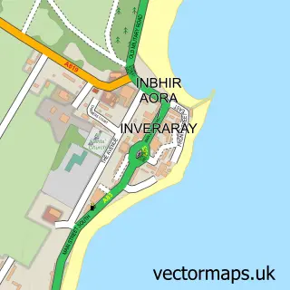
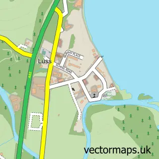
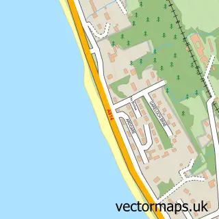
This Arrochar street map is a detailed vector street map covering a 750m x 750m area. Select a larger area to create and download your own vector street map of Arrochar.
The 750-metre map sample for Arrochar covers 74 mapped buildings and approximately 29.5 km of road detail, of which 8 named roads are named. The immediate area includes 1 GP surgery and 3 pubs. The wider area around Arrochar features 3 food and drink venues and 7 hotels. To create a larger or custom map of Arrochar, the map builder lets you define your own coverage area and download editable SVG, PDF and PNG files.
Create a larger editable map of Arrochar
Choose any area you need and generate a high-quality vector map instantly. Perfect for print, planning, design, business and personal use.

This Arrochar street map in Dunbartonshire is available as downloadable SVG, PDF and PNG map files, or as a printed map for planning, business, display, education, local information and design work. You can also create a larger custom map area using the map selector.
What this Arrochar map sample shows
Arrochar lies within Argyll And Bute parish, part of Lomond North ward in the Argyll And Bute local authority area. The postcode geography for this area includes the G postcode area, the G83 postcode district and the G83 7 postcode sector. Residents fall under the Highland for NHS services.
Local features near Arrochar
Within 2 milesAmenities and services in and around Arrochar.
Administrative and postcode information for Arrochar
The local authority covering Arrochar is Argyll And Bute, within the county of Dunbartonshire. The settlement lies within Lomond North ward and Argyll And Bute civil parish. The G83 postcode district and G83 7 postcode sector serve the immediate area. NHS provision in the area is delivered through Highland.
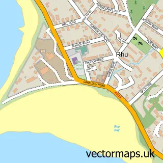
Nearby street map samples around Arrochar


More street maps in Dunbartonshire
750 metre map area coverage
Boundary, postcode and point of interest information for the 750m x 750m rectangle centred on this sample map.
Boundaries containing map centre
Constituency: Argyll, Bute and South Lochaber Co Const
District: Argyll and Bute
Icb: Highland
Postcode District: G83
Postcode Sector: G83 7
Ward: Lomond North Ward
Nearby boundaries intersecting sample
No additional intersecting boundaries found.
Postcode coverage
POI category counts
Hotel: 7
Bed And Breakfast: 4
Pub: 3
Arts And Crafts: 1
Bar: 1
Beauty And Spa: 1
Bike Repair Maintenance: 1
Caterer: 1
Catholic Church: 1
Community Services Non Profits: 1
Sample points of interest
- Mansfield Studios
- The Cobbler Bar Arrochar
- Arrochar Alps Retreat
- Burnbrae B&B
- Burnbrae Bed and Breakfast
- Fascadail Country Guest House
- Seabank B&B
- Campbell Bike Workshop
- Association of Scotland Self Caterers
- Arrochar
- Arrochar Mountain Rescue Team
- Campbell Cottage
Create a larger editable map of Arrochar
This sample shows only a 750 metre area. To create a larger map of Arrochar, use our map builder to choose your own coverage area, add titles and download editable SVG, PDF and PNG files.
Create a custom map of Arrochar