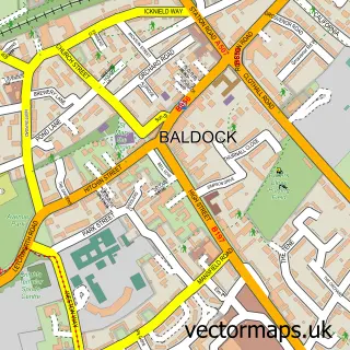
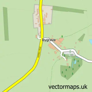
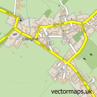
This Ashwell street map is a detailed vector street map covering a 750m x 750m area. Select a larger area to create and download your own vector street map of Ashwell.
The 750-metre map sample for Ashwell covers 354 mapped buildings and approximately 14.9 km of road detail, of which 27 named roads are named. The immediate area includes 1 school, 1 GP surgery, 3 pubs and 1 MOT station within 2 miles. The wider area around Ashwell features 2 tourism points of interest, 4 food and drink venues and 1 campsite within 2 miles. To create a larger or custom map of Ashwell, the map builder lets you define your own coverage area and download editable SVG, PDF and PNG files.
Create a larger editable map of Ashwell
Choose any area you need and generate a high-quality vector map instantly. Perfect for print, planning, design, business and personal use.

This Ashwell street map in Hertfordshire is available as downloadable SVG, PDF and PNG map files, or as a printed map for planning, business, display, education, local information and design work. You can also create a larger custom map area using the map selector.
What this Ashwell map sample shows
Ashwell lies within Ashwell Cp parish, part of Arbury ward in the North Hertfordshire District local authority area. The postcode geography for this area includes the SG postcode area, the SG7 postcode district and the SG7 5 postcode sector. Residents fall under the Nhs Hertfordshire And West Essex Integrated Care Board for NHS services.
Local features near Ashwell
Within 2 milesAmenities and services in and around Ashwell.
Administrative and postcode information for Ashwell
Ashwell lies within Ashwell Cp parish, part of Arbury ward in the North Hertfordshire District local authority area. The postcode geography for this area includes the SG postcode area, the SG7 postcode district and the SG7 5 postcode sector. Residents fall under the Nhs Hertfordshire And West Essex Integrated Care Board for NHS services.
Nearby street map samples around Ashwell

More street maps in Hertfordshire
750 metre map area coverage
Boundary, postcode and point of interest information for the 750m x 750m rectangle centred on this sample map.
Boundaries containing map centre
Constituency: North East Hertfordshire Co Const
County: Hertfordshire County
District: North Hertfordshire District
Icb: NHS Central East ICB
Parish: Ashwell CP
Police Force: hertfordshire
Postcode District: SG7
Postcode Sector: SG7 5
Ward: Arbury Ward
Nearby boundaries intersecting sample
No additional intersecting boundaries found.
Postcode coverage
POI category counts
Beauty Salon: 4
Dentist: 3
Education: 3
Pub: 3
Bar: 2
Doctor: 2
Home Service: 2
Scout Hall: 2
Accommodation: 1
Advertising Agency: 1
Sample points of interest
- Ashwell Village
- Whitecube Marketing
- Amber Osteopathy
- St Mary's Ashwell
- Snow Refrigeration
- Ashwell Gallery
- Veteran Car Company Ltd
- Days Bakery
- The Cock Pub
- The Rose & Crown
- Beauty by Chloe
- Bradleys Hairdressers
Create a larger editable map of Ashwell
This sample shows only a 750 metre area. To create a larger map of Ashwell, use our map builder to choose your own coverage area, add titles and download editable SVG, PDF and PNG files.
Create a custom map of Ashwell