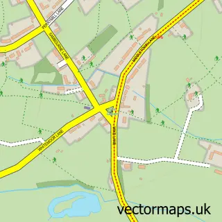
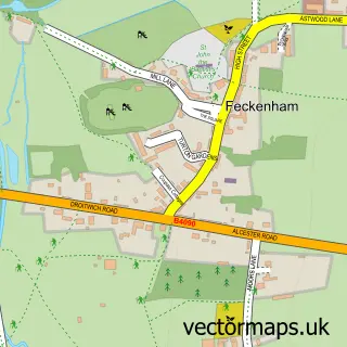
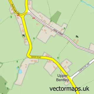
This Astwood Bank street map is a detailed vector street map covering a 750m x 750m area. Select a larger area to create and download your own vector street map of Astwood Bank.
The 750-metre map sample for Astwood Bank covers 400 mapped buildings and approximately 22.2 km of road detail, of which 26 named roads are named. The immediate area includes 1 school, 1 GP surgery, with 4 within 2 miles, 4 pubs and 5 MOT stations within 2 miles. The wider area around Astwood Bank features 1 tourism point of interest and 5 food and drink venues. To create a larger or custom map of Astwood Bank, the map builder lets you define your own coverage area and download editable SVG, PDF and PNG files.
Create a larger editable map of Astwood Bank
Choose any area you need and generate a high-quality vector map instantly. Perfect for print, planning, design, business and personal use.

This Astwood Bank street map in Worcestershire is available as downloadable SVG, PDF and PNG map files, or as a printed map for planning, business, display, education, local information and design work. You can also create a larger custom map area using the map selector.
What this Astwood Bank map sample shows
Astwood Bank lies within Worcestershire County parish, part of Astwood Bank And Feckenham ward in the Redditch District (B) local authority area. The postcode geography for this area includes the B postcode area, the B96 postcode district and the B96 6 postcode sector. Residents fall under the Nhs Herefordshire And Worcestershire Integrated Care Board for NHS services.
Local features near Astwood Bank
Within 2 milesAmenities and services in and around Astwood Bank.
Administrative and postcode information for Astwood Bank
The local authority covering Astwood Bank is Redditch District (B), within the county of Worcestershire. The settlement lies within Astwood Bank And Feckenham ward and Worcestershire County civil parish. The B96 postcode district and B96 6 postcode sector serve the immediate area. NHS provision in the area is delivered through Worcestershire Acute Hospitals Nhs Trust.
Nearby street map samples around Astwood Bank

More street maps in Worcestershire
750 metre map area coverage
Boundary, postcode and point of interest information for the 750m x 750m rectangle centred on this sample map.
Boundaries containing map centre
Constituency: Redditch Co Const
County: Worcestershire County
District: Redditch District (B)
Icb: NHS Herefordshire and Worcestershire ICB
Police Force: west mercia
Postcode District: B96
Postcode Sector: B96 6
Ward: Astwood Bank & Feckenham Ward
Nearby boundaries intersecting sample
Constituency: Stratford-on-Avon Co Const
County: Warwickshire County
District: Stratford-on-Avon District
Icb: NHS Coventry and Warwickshire ICB
Parish: Sambourne CP
Police Force: warwickshire
Ward: Studley South Ward
Postcode coverage
POI category counts
Beauty Salon: 4
Pub: 4
Bar: 3
Pet Groomer: 3
Preschool: 3
Automotive Repair: 2
Convenience Store: 2
Dance School: 2
Doctor: 2
Financial Service: 2
Sample points of interest
- The Alternative Accountants
- St Matthias & St George
- S P Dunn
- CSB Architectural Design Ltd
- Lighthouse Glass
- Autotech
- S P Components
- Vulco Spring & Presswork Co Ltd
- Astwood Bakery Ltd
- Bank Cafe & Bar
- Red Lion
- The Coach House
Create a larger editable map of Astwood Bank
This sample shows only a 750 metre area. To create a larger map of Astwood Bank, use our map builder to choose your own coverage area, add titles and download editable SVG, PDF and PNG files.
Create a custom map of Astwood Bank