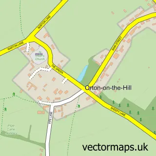
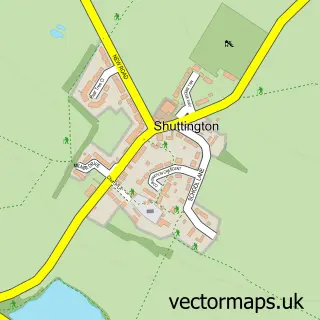
This Austrey street map is a detailed vector street map covering a 750m x 750m area. Select a larger area to create and download your own vector street map of Austrey.
The 750-metre map sample for Austrey covers 271 mapped buildings and approximately 17.7 km of road detail, of which 22 named roads are named. The immediate area includes 1 school and 2 pubs. The wider area around Austrey features 2 food and drink venues. To create a larger or custom map of Austrey, the map builder lets you define your own coverage area and download editable SVG, PDF and PNG files.
Create a larger editable map of Austrey
Choose any area you need and generate a high-quality vector map instantly. Perfect for print, planning, design, business and personal use.

This Austrey street map in Warwickshire is available as downloadable SVG, PDF and PNG map files, or as a printed map for planning, business, display, education, local information and design work. You can also create a larger custom map area using the map selector.
What this Austrey map sample shows
Austrey lies within Austrey Cp parish, part of Newton Regis And Warton ward in the North Warwickshire District (B) local authority area. The postcode geography for this area includes the CV postcode area, the CV9 postcode district and the CV9 3 postcode sector. Residents fall under the Nhs Coventry And Warwickshire Integrated Care Board for NHS services.
Local features near Austrey
Within 2 milesAmenities and services in and around Austrey.
Administrative and postcode information for Austrey
The local authority covering Austrey is North Warwickshire District (B), within the county of Warwickshire. The settlement lies within Newton Regis And Warton ward and Austrey Cp civil parish. The CV9 postcode district and CV9 3 postcode sector serve the immediate area. NHS provision in the area is delivered through George Eliot Hospital Nhs Trust.
Nearby street map samples around Austrey

More street maps in Warwickshire
750 metre map area coverage
Boundary, postcode and point of interest information for the 750m x 750m rectangle centred on this sample map.
Boundaries containing map centre
Constituency: North Warwickshire and Bedworth Co Const
County: Warwickshire County
District: North Warwickshire District (B)
Icb: NHS Coventry and Warwickshire ICB
Parish: Austrey CP
Police Force: warwickshire
Postcode District: CV9
Postcode Sector: CV9 3
Ward: Newton Regis and Warton Ward
Nearby boundaries intersecting sample
No additional intersecting boundaries found.
Postcode coverage
POI category counts
Convenience Store: 2
Plumbing: 2
Pub: 2
Anglican Church: 1
Automotive Repair: 1
Bakery: 1
Bartender: 1
Church Cathedral: 1
Clothing Store: 1
Contractor: 1
Sample points of interest
- St Nicholas, Austrey
- Bak-rak Ltd
- Designed At 26
- Down The Hatch Events
- St Nicholas's Church
- Be Up to Date by Finding the Fashion Trend News
- LKH Developments
- Premier
- Premier Austrey Stores
- Post Office Travel Money
- Nu-fashion
- Austrey C of E Primary School
Create a larger editable map of Austrey
This sample shows only a 750 metre area. To create a larger map of Austrey, use our map builder to choose your own coverage area, add titles and download editable SVG, PDF and PNG files.
Create a custom map of Austrey