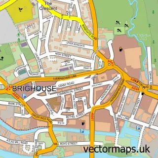
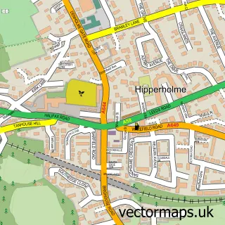
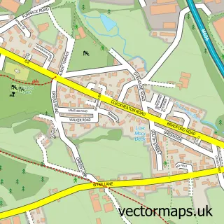
This Bailiff Bridge street map is a detailed vector street map covering a 750m x 750m area. Select a larger area to create and download your own vector street map of Bailiff Bridge.
The 750-metre map sample for Bailiff Bridge covers 293 mapped buildings and approximately 15.0 km of road detail, of which 27 named roads are named. The immediate area includes 1 school, 4 GP surgeries within 2 miles and 2 MOT stations, with 15 within 2 miles. The wider area around Bailiff Bridge features 1 tourism point of interest and 1 food and drink venue. To create a larger or custom map of Bailiff Bridge, the map builder lets you define your own coverage area and download editable SVG, PDF and PNG files.
Create a larger editable map of Bailiff Bridge
Choose any area you need and generate a high-quality vector map instantly. Perfect for print, planning, design, business and personal use.

This Bailiff Bridge street map in West Yorkshire is available as downloadable SVG, PDF and PNG map files, or as a printed map for planning, business, display, education, local information and design work. You can also create a larger custom map area using the map selector.
What this Bailiff Bridge map sample shows
Bailiff Bridge lies within Kirklees District (B) parish, part of Cleckheaton ward in the Kirklees District (B) local authority area. The postcode geography for this area includes the BD postcode area, the BD19 postcode district and the BD19 6 postcode sector. Residents fall under the Nhs West Yorkshire Integrated Care Board for NHS services.
Local features near Bailiff Bridge
Within 2 milesAmenities and services in and around Bailiff Bridge.
Administrative and postcode information for Bailiff Bridge
Bailiff Bridge lies within Kirklees District (B) parish, part of Cleckheaton ward in the Kirklees District (B) local authority area. The postcode geography for this area includes the BD postcode area, the BD19 postcode district and the BD19 6 postcode sector. Residents fall under the Nhs West Yorkshire Integrated Care Board for NHS services.
Nearby street map samples around Bailiff Bridge

More street maps in West Yorkshire
750 metre map area coverage
Boundary, postcode and point of interest information for the 750m x 750m rectangle centred on this sample map.
Boundaries containing map centre
Constituency: Calder Valley Co Const
District: Calderdale District (B)
Icb: NHS West Yorkshire ICB
Police Force: west yorkshire
Postcode District: HD6
Postcode Sector: HD6 4
Ward: Hipperholme and Lightcliffe Ward
Nearby boundaries intersecting sample
Constituency: Bradford South Boro Const, Spen Valley Boro Const
District: Bradford District (B), Kirklees District (B)
Postcode District: BD12
Postcode Sector: BD12 9
Ward: Cleckheaton Ward, Wyke Ward
Postcode coverage
POI category counts
Hair Salon: 6
Advertising Agency: 3
Bridal Shop: 3
Carpet Store: 3
Dentist: 3
Post Office: 3
Professional Services: 3
Beauty Salon: 2
Building Supply Store: 2
Dance School: 2
Sample points of interest
- Brosnans
- Monster Displays
- Pawlo Designs Ltd
- Sales Factory
- ATM (Post Office)
- Asset Sales
- Cutting edge vinyls
- MG Lifestyle (UK) Ltd.
- Retro Sports Cars Ltd
- High Class Motors of Bailiff Bridge
- Nichola hart barbers
- Be-you-tiful
Create a larger editable map of Bailiff Bridge
This sample shows only a 750 metre area. To create a larger map of Bailiff Bridge, use our map builder to choose your own coverage area, add titles and download editable SVG, PDF and PNG files.
Create a custom map of Bailiff Bridge