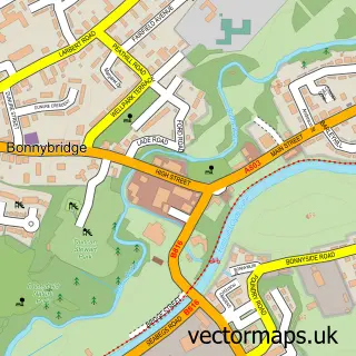
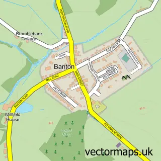
This Banknock street map is a detailed vector street map covering a 750m x 750m area. Select a larger area to create and download your own vector street map of Banknock.
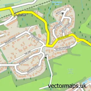
The 750-metre map sample for Banknock covers 282 mapped buildings and approximately 14.6 km of road detail, of which 26 named roads are named. The immediate area includes 1 MOT station, with 4 within 2 miles. The wider area around Banknock features 2 food and drink venues and 1 hotel. To create a larger or custom map of Banknock, the map builder lets you define your own coverage area and download editable SVG, PDF and PNG files.
Create a larger editable map of Banknock
Choose any area you need and generate a high-quality vector map instantly. Perfect for print, planning, design, business and personal use.

This Banknock street map in Stirling and Falkirk is available as downloadable SVG, PDF and PNG map files, or as a printed map for planning, business, display, education, local information and design work. You can also create a larger custom map area using the map selector.
What this Banknock map sample shows
Banknock lies within Falkirk parish, part of Denny And Banknock ward in the Falkirk local authority area. The postcode geography for this area includes the FK postcode area, the FK4 postcode district and the FK4 1 postcode sector. Residents fall under the Forth Valley for NHS services.
Local features near Banknock
Within 2 milesAmenities and services in and around Banknock.
Administrative and postcode information for Banknock
The local authority covering Banknock is Falkirk, within the county of Stirling And Falkirk. The settlement lies within Denny And Banknock ward and Falkirk civil parish. The FK4 postcode district and FK4 1 postcode sector serve the immediate area. NHS provision in the area is delivered through Forth Valley.
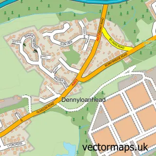
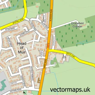
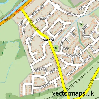
Nearby street map samples around Banknock

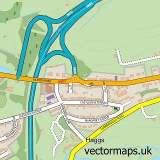
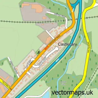
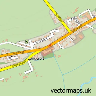
More street maps in Stirling and Falkirk
750 metre map area coverage
Boundary, postcode and point of interest information for the 750m x 750m rectangle centred on this sample map.
Boundaries containing map centre
Constituency: Falkirk Co Const
District: Falkirk
Icb: Forth Valley
Postcode District: FK4
Postcode Sector: FK4 1
Ward: Denny and Banknock Ward
Nearby boundaries intersecting sample
Constituency: Cumbernauld and Kirkintilloch Co Const
District: North Lanarkshire
Postcode Sector: FK4 2
Ward: Kilsyth Ward
Postcode coverage
POI category counts
Convenience Store: 7
Gas Station: 3
Package Locker: 3
Atms: 2
Automotive Repair: 2
Building Supply Store: 2
Taxi Service: 2
Assisted Living Facility: 1
Automotive Services And Repair: 1
Barbecue Restaurant: 1
Sample points of interest
- Holmes Care Group Bankview Care Home
- Hollandbush Supersave (Swap)
- PayPoint
- Central MOTs
- Legend Autobody Shop
- Pitcairn Engineering
- Wee Grill
- Krop Shop
- A.M Property Maintenance
- The Coyle Cleaning Co
- Gourmet Cafe
- Stirling Chiropractic
Create a larger editable map of Banknock
This sample shows only a 750 metre area. To create a larger map of Banknock, use our map builder to choose your own coverage area, add titles and download editable SVG, PDF and PNG files.
Create a custom map of Banknock