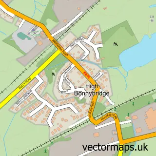
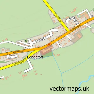
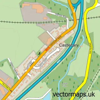
This Bonnybridge street map is a detailed vector street map covering a 750m x 750m area. Select a larger area to create and download your own vector street map of Bonnybridge.
The 750-metre map sample for Bonnybridge covers 243 mapped buildings and approximately 12.6 km of road detail, of which 29 named roads are named. The immediate area includes 2 GP surgeries, with 4 within 2 miles, 4 pubs and 1 MOT station, with 10 within 2 miles. The wider area around Bonnybridge features 2 tourism points of interest, 11 food and drink venues and 1 hotel. To create a larger or custom map of Bonnybridge, the map builder lets you define your own coverage area and download editable SVG, PDF and PNG files.
Create a larger editable map of Bonnybridge
Choose any area you need and generate a high-quality vector map instantly. Perfect for print, planning, design, business and personal use.

This Bonnybridge street map in Stirling and Falkirk is available as downloadable SVG, PDF and PNG map files, or as a printed map for planning, business, display, education, local information and design work. You can also create a larger custom map area using the map selector.
What this Bonnybridge map sample shows
Bonnybridge lies within Falkirk parish, part of Bonnybridge And Larbert ward in the Falkirk local authority area. The postcode geography for this area includes the FK postcode area, the FK4 postcode district and the FK4 1 postcode sector. Residents fall under the Forth Valley for NHS services.
Local features near Bonnybridge
Within 2 milesAmenities and services in and around Bonnybridge.
Administrative and postcode information for Bonnybridge
The local authority covering Bonnybridge is Falkirk, within the county of Stirling And Falkirk. The settlement lies within Bonnybridge And Larbert ward and Falkirk civil parish. The FK4 postcode district and FK4 1 postcode sector serve the immediate area. NHS provision in the area is delivered through Forth Valley.
Nearby street map samples around Bonnybridge

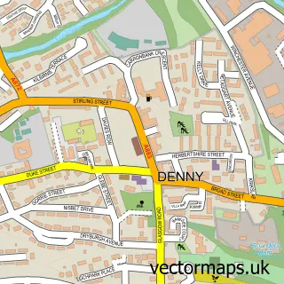
More street maps in Stirling and Falkirk
750 metre map area coverage
Boundary, postcode and point of interest information for the 750m x 750m rectangle centred on this sample map.
Boundaries containing map centre
Constituency: Falkirk Co Const
District: Falkirk
Icb: Forth Valley
Postcode District: FK4
Postcode Sector: FK4 1
Ward: Bonnybridge and Larbert Ward
Nearby boundaries intersecting sample
Postcode Sector: FK4 2
Postcode coverage
POI category counts
Beauty Salon: 14
Automotive Repair: 5
Convenience Store: 5
Barber: 4
Beauty And Spa: 4
Pharmacy: 4
Pub: 4
Betting Center: 3
Cafe: 3
Courier And Delivery Services: 3
Sample points of interest
- Bonnybridge Gallery
- Balhousie Wheatlands Care Home
- Belhousie Care Group
- Canalbank Auction
- Napier Accommodation Services Ltd.
- Apollo Diesel Injection
- Auto Doctor
- B T S Garage Services
- David Morris
- W H Tyres Limited
- Appliance Repairs
- Greggs
Create a larger editable map of Bonnybridge
This sample shows only a 750 metre area. To create a larger map of Bonnybridge, use our map builder to choose your own coverage area, add titles and download editable SVG, PDF and PNG files.
Create a custom map of Bonnybridge