Vector Maps logo
Home Why it works Popular maps Districts Samples Customizer Create Your Map
VectorMaps.uk
Home Popular maps Districts Samples Customizer Create Your Map Privacy Disclaimer
Home / UK Maps / Stirling and Falkirk / High Bonnybridge Map

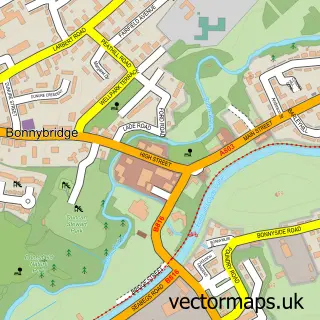
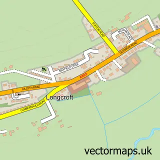
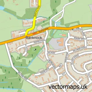
This High Bonnybridge street map is a detailed vector street map covering a 750m x 750m area. Select a larger area to create and download your own vector street map of High Bonnybridge.

High Bonnybridge is a village in Stirling And Falkirk, in the Central Scotland of Scotland. Historically, the area formed part of Stirlingshire. The settlement falls within the Falkirk parliamentary constituency. It is served by the FK4 postcode district,

The 750-metre map sample for High Bonnybridge covers 190 mapped buildings and approximately 12.7 km of road detail, of which 12 named roads are named. The immediate area includes 2 GP surgeries within 2 miles, 1 pub and 6 MOT stations within 2 miles. The wider area around High Bonnybridge features 1 food and drink venue and 2 campsites within 2 miles. To create a larger or custom map of High Bonnybridge, the map builder lets you define your own coverage area and download editable SVG, PDF and PNG files.

190Buildings
12.65 kmRoads
12Named roads
0Residents within 2 miles
Create your own

Create a larger editable map of High Bonnybridge

Choose any area you need and generate a high-quality vector map instantly. Perfect for print, planning, design, business and personal use.

Choose any location
Editable SVG files
Any size up to A0
PDF, PNG & more
Instant download
High quality guaranteed
Create My Custom Map
Secure, private & no credit card required
High Bonnybridge Vector Street Map
750m Sample
High Bonnybridge vector street map sample showing roads, buildings and local features in a 750 metre preview area
Buy High Bonnybridge Map Print from £12.95 Buy High Bonnybridge Digital Map from £6

This High Bonnybridge street map in Stirling and Falkirk is available as downloadable SVG, PDF and PNG map files, or as a printed map for planning, business, display, education, local information and design work. You can also create a larger custom map area using the map selector.

What this High Bonnybridge map sample shows

High Bonnybridge lies within Falkirk parish, part of Bonnybridge And Larbert ward in the Falkirk local authority area. The postcode geography for this area includes the FK postcode area, the FK4 postcode district and the FK4 2 postcode sector. Residents fall under the Forth Valley for NHS services.

Local features near High Bonnybridge

Within 2 miles

Amenities and services in and around High Bonnybridge.

2 Campsites within 2 miles
2 GP surgeries within 2 miles
6 MOT stations within 2 miles
1 Food & drink
1 Pubs
1 Vehicle services

Counts are approximate and based on publicly available data.

Administrative and postcode information for High Bonnybridge

The local authority covering High Bonnybridge is Falkirk, within the county of Stirling And Falkirk. The settlement lies within Bonnybridge And Larbert ward and Falkirk civil parish. The FK4 postcode district and FK4 2 postcode sector serve the immediate area. NHS provision in the area is delivered through Forth Valley.

Parish FALKIRK
Ward Bonnybridge and Larbert
District / local authority Falkirk
County Stirling and Falkirk
Historic county Stirlingshire
Postcode district FK4
Postcode sector FK4 2
Parliamentary constituency Falkirk
Region Central Scotland
Country Scotland

Nearby street map samples around High Bonnybridge

Street map sample of Bonnybridge, Stirling and Falkirk Bonnybridge Town - Stirling and Falkirk - 0.7 miles Street map sample of Stirling, Stirling and Falkirk Stirling City - Stirling and Falkirk - 8.9 miles Street map sample of Greenhill, Stirling and Falkirk Greenhill Village - Stirling and Falkirk - 0.6 miles Street map sample of Dennyloanhead, Stirling and Falkirk Dennyloanhead Village - Stirling and Falkirk - 1.3 miles Street map sample of Head of Muir, Stirling and Falkirk Head of Muir Village - Stirling and Falkirk - 1.5 miles Street map sample of Longcroft, Stirling and Falkirk Longcroft Village - Stirling and Falkirk - 2.0 miles Street map sample of Haggs, Stirling and Falkirk Haggs Village - Stirling and Falkirk - 2.4 miles Street map sample of Dunipace, Stirling and Falkirk Dunipace Village - Stirling and Falkirk - 2.7 miles Street map sample of Castlecary, Dunbartonshire Castlecary Village - Dunbartonshire - 2.9 miles Street map sample of Banknock, Stirling and Falkirk Banknock Village - Stirling and Falkirk - 3.0 miles

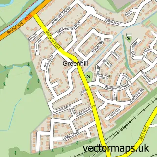
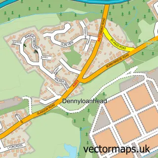
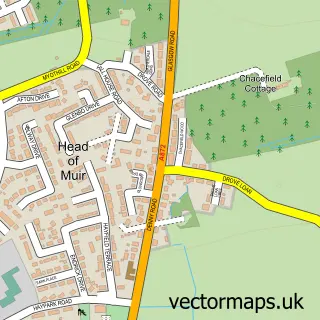
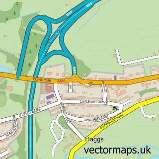
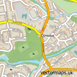
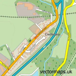
More street maps in Stirling and Falkirk

Street map sample of Greenhill, Stirling and Falkirk Greenhill Village - 0.6 miles Street map sample of Bonnybridge, Stirling and Falkirk Bonnybridge Town - 0.7 miles Street map sample of Dennyloanhead, Stirling and Falkirk Dennyloanhead Village - 1.3 miles Street map sample of Head of Muir, Stirling and Falkirk Head of Muir Village - 1.5 miles Street map sample of Longcroft, Stirling and Falkirk Longcroft Village - 2.0 miles

750 metre map area coverage

Boundary, postcode and point of interest information for the 750m x 750m rectangle centred on this sample map.

Boundaries containing map centre

Constituency: Falkirk Co Const

District: Falkirk

Icb: Forth Valley

Postcode District: FK4

Postcode Sector: FK4 2

Ward: Bonnybridge and Larbert Ward

Nearby boundaries intersecting sample

No additional intersecting boundaries found.

Postcode coverage

FK4 FK4 2

POI category counts

Retail: 2

Automotive Repair: 1

Bakery: 1

Building Supply Store: 1

Business Manufacturing And Supply: 1

Catholic Church: 1

Elementary School: 1

Freight And Cargo Service: 1

Home Cleaning: 1

Pet Sitting: 1

Sample points of interest

  • All Truck Commercial Vehicle Repairs Automotive Repair
  • Just BAKED Bakery
  • George's Carpets Building Supply Store
  • RHI UK Business Manufacturing And Supply
  • St. Joseph’s Catholic Church Catholic Church
  • St Joseph's RC Primary School Elementary School
  • Ian Craig Freight And Cargo Service
  • LCM Specialist Services Home Cleaning
  • Woodchip cattery Pet Sitting
  • The Broomhill Inn Pub
  • Alloys Direct Retail
  • Alpha Installations Retail

Create a larger editable map of High Bonnybridge

This sample shows only a 750 metre area. To create a larger map of High Bonnybridge, use our map builder to choose your own coverage area, add titles and download editable SVG, PDF and PNG files.

Create a custom map of High Bonnybridge

Phone 01751 473136 | Copyright Vectormaps.uk 2026

Samples Customizer Privacy Disclaimer
High Bonnybridge Vector Street Map
High Bonnybridge enlarged street map sample showing a 750 metre preview area