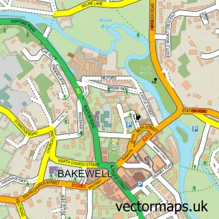
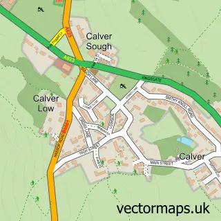
This Baslow street map is a detailed vector street map covering a 750m x 750m area. Select a larger area to create and download your own vector street map of Baslow.
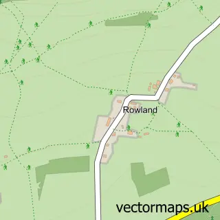
The 750-metre map sample for Baslow covers 259 mapped buildings and approximately 21.0 km of road detail, of which 18 named roads are named. The immediate area includes 1 school, 1 GP surgery, 2 pubs and 1 MOT station within 2 miles. The wider area around Baslow features 2 food and drink venues and 3 hotels. To create a larger or custom map of Baslow, the map builder lets you define your own coverage area and download editable SVG, PDF and PNG files.
Create a larger editable map of Baslow
Choose any area you need and generate a high-quality vector map instantly. Perfect for print, planning, design, business and personal use.

This Baslow street map in Derbyshire is available as downloadable SVG, PDF and PNG map files, or as a printed map for planning, business, display, education, local information and design work. You can also create a larger custom map area using the map selector.
What this Baslow map sample shows
Baslow lies within Baslow And Bubnell Cp parish, part of Chatsworth ward in the Derbyshire Dales District local authority area. The postcode geography for this area includes the DE postcode area, the DE45 postcode district and the DE45 1 postcode sector. Residents fall under the Nhs Derby And Derbyshire Integrated Care Board for NHS services.
Local features near Baslow
Within 2 milesAmenities and services in and around Baslow.
Administrative and postcode information for Baslow
The local authority covering Baslow is Derbyshire Dales District, within the county of Derbyshire. The settlement lies within Chatsworth ward and Baslow And Bubnell Cp civil parish. The DE45 postcode district and DE45 1 postcode sector serve the immediate area. NHS provision in the area is delivered through Chesterfield Royal Hospital Nhs Foundation Trust.
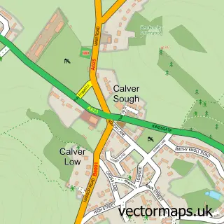
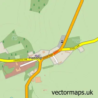
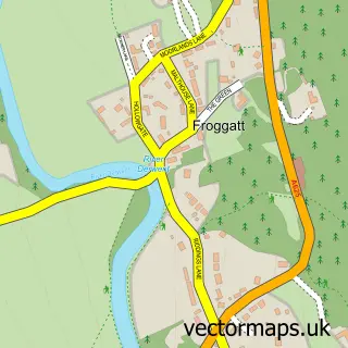
Nearby street map samples around Baslow

More street maps in Derbyshire
750 metre map area coverage
Boundary, postcode and point of interest information for the 750m x 750m rectangle centred on this sample map.
Boundaries containing map centre
Constituency: Derbyshire Dales Co Const
County: Derbyshire County
District: Derbyshire Dales District
Icb: NHS Derby and Derbyshire ICB
Parish: Baslow and Bubnell CP
Police Force: derbyshire
Postcode District: DE45
Postcode Sector: DE45 1
Ward: Chatsworth Ward
Nearby boundaries intersecting sample
No additional intersecting boundaries found.
Postcode coverage
POI category counts
Convenience Store: 4
Church Cathedral: 3
Hotel: 3
Sports Club And League: 3
Community Center: 2
Flowers And Gifts Shop: 2
Holiday Rental Home: 2
Pub: 2
Active Life: 1
Art Gallery: 1
Sample points of interest
- Baslow Bowls Club
- Church Farm Art Gallery
- Whitehorse Gallery
- The Stage
- Baslow Beauty Salon
- Charlie's
- Fired Up Heating Services
- Hulleys of Baslow
- Baslow Parish Church
- St Anne's Church
- St Anne's Church
- Baslow Church Rooms
Create a larger editable map of Baslow
This sample shows only a 750 metre area. To create a larger map of Baslow, use our map builder to choose your own coverage area, add titles and download editable SVG, PDF and PNG files.
Create a custom map of Baslow