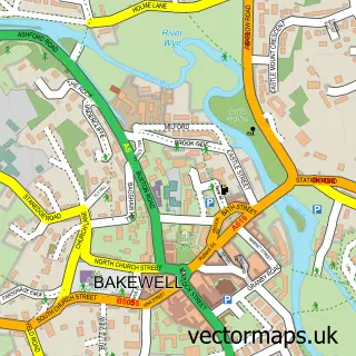
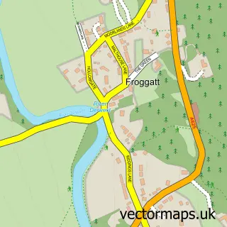
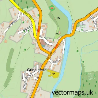
This Calver street map is a detailed vector street map covering a 750m x 750m area. Select a larger area to create and download your own vector street map of Calver.
The 750-metre map sample for Calver covers 192 mapped buildings and approximately 16.0 km of road detail, of which 16 named roads are named. The immediate area includes 2 GP surgeries within 2 miles, 3 pubs and 1 MOT station, with 2 within 2 miles. The wider area around Calver features 2 tourism points of interest, 7 food and drink venues and 1 hotel. To create a larger or custom map of Calver, the map builder lets you define your own coverage area and download editable SVG, PDF and PNG files.
Create a larger editable map of Calver
Choose any area you need and generate a high-quality vector map instantly. Perfect for print, planning, design, business and personal use.

This Calver street map in Derbyshire is available as downloadable SVG, PDF and PNG map files, or as a printed map for planning, business, display, education, local information and design work. You can also create a larger custom map area using the map selector.
What this Calver map sample shows
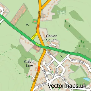
Calver lies within Calver Cp parish, part of Calver ward in the Derbyshire Dales District local authority area. The postcode geography for this area includes the S postcode area, the S32 postcode district and the S32 3 postcode sector. Residents fall under the Nhs Derby And Derbyshire Integrated Care Board for NHS services.
Local features near Calver
Within 2 milesAmenities and services in and around Calver.
Administrative and postcode information for Calver
The local authority covering Calver is Derbyshire Dales District, within the county of Derbyshire. The settlement lies within Calver ward and Calver Cp civil parish. The S32 postcode district and S32 3 postcode sector serve the immediate area. NHS provision in the area is delivered through Chesterfield Royal Hospital Nhs Foundation Trust.
Nearby street map samples around Calver

More street maps in Derbyshire
750 metre map area coverage
Boundary, postcode and point of interest information for the 750m x 750m rectangle centred on this sample map.
Boundaries containing map centre
Constituency: Derbyshire Dales Co Const
County: Derbyshire County
District: Derbyshire Dales District
Icb: NHS Derby and Derbyshire ICB
Parish: Calver CP
Police Force: derbyshire
Postcode District: S32
Postcode Sector: S32 3
Ward: Calver & Longstone Ward
Nearby boundaries intersecting sample
No additional intersecting boundaries found.
Postcode coverage
POI category counts
Convenience Store: 4
Gas Station: 3
Pub: 3
Coffee Shop: 2
Fashion Accessories Store: 2
Post Office: 2
Sporting Goods: 2
Auto Loan Provider: 1
Business: 1
Butcher Shop: 1
Sample points of interest
- Hope Valley Mortgages
- Scott Douglas Group
- Fischer And Co
- Outside
- The Little Sweet Shop
- Mimosastyle Ltd
- Costa Express
- Insomnia
- SPAR
- SPAR
- SPAR - Calver Sough
- White's Spar Store
Create a larger editable map of Calver
This sample shows only a 750 metre area. To create a larger map of Calver, use our map builder to choose your own coverage area, add titles and download editable SVG, PDF and PNG files.
Create a custom map of Calver