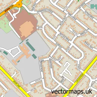
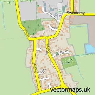
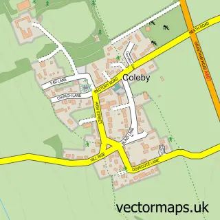
This Bassingham street map is a detailed vector street map covering a 750m x 750m area. Select a larger area to create and download your own vector street map of Bassingham.
The 750-metre map sample for Bassingham covers 403 mapped buildings and approximately 14.2 km of road detail, of which 21 named roads are named. The immediate area includes 1 school, 1 GP surgery, 3 pubs and 1 MOT station. The wider area around Bassingham features 3 food and drink venues. To create a larger or custom map of Bassingham, the map builder lets you define your own coverage area and download editable SVG, PDF and PNG files.
Create a larger editable map of Bassingham
Choose any area you need and generate a high-quality vector map instantly. Perfect for print, planning, design, business and personal use.

This Bassingham street map in Lincolnshire is available as downloadable SVG, PDF and PNG map files, or as a printed map for planning, business, display, education, local information and design work. You can also create a larger custom map area using the map selector.
What this Bassingham map sample shows
Bassingham lies within Bassingham Cp parish, part of Bassingham And Brant Broughton ward in the North Kesteven District local authority area. The postcode geography for this area includes the LN postcode area, the LN5 postcode district and the LN5 9 postcode sector. Residents fall under the Nhs Lincolnshire Integrated Care Board for NHS services.
Local features near Bassingham
Within 2 milesAmenities and services in and around Bassingham.
Administrative and postcode information for Bassingham
The local authority covering Bassingham is North Kesteven District, within the county of Lincolnshire. The settlement lies within Bassingham And Brant Broughton ward and Bassingham Cp civil parish. The LN5 postcode district and LN5 9 postcode sector serve the immediate area. NHS provision in the area is delivered through United Lincolnshire Hospitals Nhs Trust.
Nearby street map samples around Bassingham

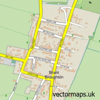
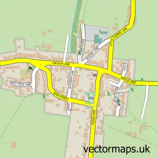
More street maps in Lincolnshire
750 metre map area coverage
Boundary, postcode and point of interest information for the 750m x 750m rectangle centred on this sample map.
Boundaries containing map centre
Constituency: Sleaford and North Hykeham Co Const
County: Lincolnshire County
District: North Kesteven District
Icb: NHS Lincolnshire ICB
Parish: Bassingham CP
Police Force: lincolnshire
Postcode District: LN5
Postcode Sector: LN5 9
Ward: Bassingham Rural Ward
Nearby boundaries intersecting sample
Parish: Norton Disney CP, Thurlby CP
Postcode District: LN6
Postcode Sector: LN6 9
Postcode coverage
POI category counts
Convenience Store: 3
Pub: 3
Beauty And Spa: 2
Beauty Salon: 2
Industrial Equipment: 2
Pet Store: 2
Scout Hall: 2
Active Life: 1
Advertising Agency: 1
Anglican Church: 1
Sample points of interest
- Bassingham Park
- Proof Media
- St Michael & All Angels
- Mikedaubneyarchitects
- Frame Academy
- Hammond Hall, Bassingham
- Bassingham Nursing Home
- Welton Motor Engineers Motorbikes
- The Victoria Rose Cake Company
- Love Beauty Lincoln
- Tangled
- Evolve Wellbeing & Aesthetics
Create a larger editable map of Bassingham
This sample shows only a 750 metre area. To create a larger map of Bassingham, use our map builder to choose your own coverage area, add titles and download editable SVG, PDF and PNG files.
Create a custom map of Bassingham