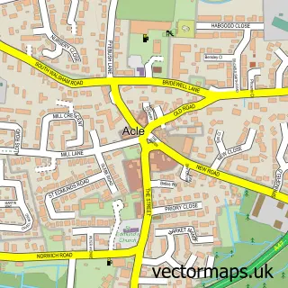
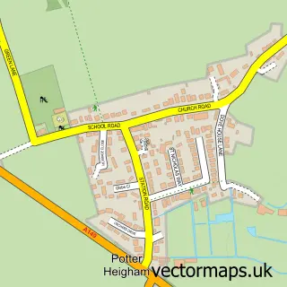
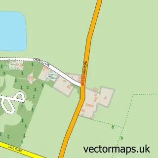
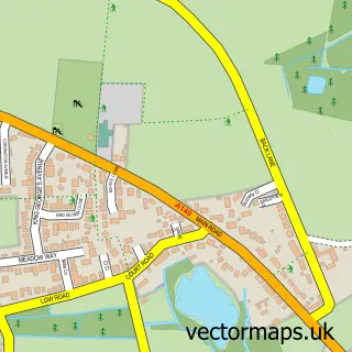
This Bastwick street map is a detailed vector street map covering a 750m x 750m area. Select a larger area to create and download your own vector street map of Bastwick.
The 750-metre map sample for Bastwick covers 164 mapped buildings and approximately 10.4 km of road detail, of which 9 named roads are named. The immediate area includes 1 MOT station, with 2 within 2 miles. The wider area around Bastwick features 1 food and drink venue. To create a larger or custom map of Bastwick, the map builder lets you define your own coverage area and download editable SVG, PDF and PNG files.
Create a larger editable map of Bastwick
Choose any area you need and generate a high-quality vector map instantly. Perfect for print, planning, design, business and personal use.

This Bastwick street map in Norfolk is available as downloadable SVG, PDF and PNG map files, or as a printed map for planning, business, display, education, local information and design work. You can also create a larger custom map area using the map selector.
What this Bastwick map sample shows
Bastwick lies within Repps With Bastwick Cp parish, part of West Flegg ward in the Great Yarmouth District (B) local authority area. The postcode geography for this area includes the NR postcode area, the NR29 postcode district and the NR29 5 postcode sector. Residents fall under the Nhs Norfolk And Waveney Integrated Care Board for NHS services.
Local features near Bastwick
Within 2 milesAmenities and services in and around Bastwick.
Administrative and postcode information for Bastwick
Bastwick lies within Repps With Bastwick Cp parish, part of West Flegg ward in the Great Yarmouth District (B) local authority area. The postcode geography for this area includes the NR postcode area, the NR29 postcode district and the NR29 5 postcode sector. Residents fall under the Nhs Norfolk And Waveney Integrated Care Board for NHS services.
Nearby street map samples around Bastwick

More street maps in Norfolk
750 metre map area coverage
Boundary, postcode and point of interest information for the 750m x 750m rectangle centred on this sample map.
Boundaries containing map centre
Constituency: Great Yarmouth Co Const
County: Norfolk County
District: Great Yarmouth District (B)
Icb: NHS Norfolk and Waveney ICB
Parish: Repps with Bastwick CP
Police Force: norfolk
Postcode District: NR29
Postcode Sector: NR29 5
Ward: West Flegg Ward
Nearby boundaries intersecting sample
No additional intersecting boundaries found.
Postcode coverage
POI category counts
Gas Station: 2
Post Office: 2
Assisted Living Facility: 1
Automotive Repair: 1
Building Supply Store: 1
Coffee Shop: 1
Convenience Store: 1
Electrician: 1
Food Delivery Service: 1
Holiday Rental Home: 1
Sample points of interest
- Pine Lodge
- Repps Garage
- Repps Domestic Cleaning
- Costa Express
- Costcutter
- Bee Safe Portable Appliance Testing
- Evri ParcelShop
- Murco
- Repps Service Station
- Bastwick Tower Holidays
- Indian Kitchen
- Thriving Minds Therapy
Create a larger editable map of Bastwick
This sample shows only a 750 metre area. To create a larger map of Bastwick, use our map builder to choose your own coverage area, add titles and download editable SVG, PDF and PNG files.
Create a custom map of Bastwick