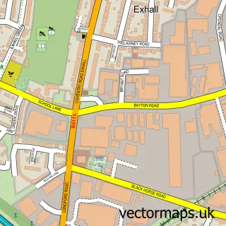
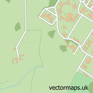
This Bedworth street map is a detailed vector street map covering a 750m x 750m area. Select a larger area to create and download your own vector street map of Bedworth.
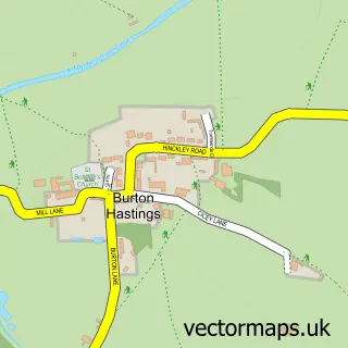
The 750-metre map sample for Bedworth covers 395 mapped buildings and approximately 32.6 km of road detail, of which 33 named roads are named. The immediate area includes 1 school, 1 railway station, 6 GP surgeries within 2 miles and 4 pubs among other local services. The wider area around Bedworth features 2 tourism points of interest and 7 food and drink venues. To create a larger or custom map of Bedworth, the map builder lets you define your own coverage area and download editable SVG, PDF and PNG files.
Create a larger editable map of Bedworth
Choose any area you need and generate a high-quality vector map instantly. Perfect for print, planning, design, business and personal use.

This Bedworth street map in Warwickshire is available as downloadable SVG, PDF and PNG map files, or as a printed map for planning, business, display, education, local information and design work. You can also create a larger custom map area using the map selector.
What this Bedworth map sample shows
Bedworth lies within Warwickshire County parish, part of Bede ward in the Nuneaton And Bedworth District (B) local authority area. The postcode geography for this area includes the CV postcode area, the CV12 postcode district and the CV12 8 postcode sector. Residents fall under the Nhs Coventry And Warwickshire Integrated Care Board for NHS services.
Local features near Bedworth
Within 2 milesAmenities and services in and around Bedworth.
Administrative and postcode information for Bedworth
The local authority covering Bedworth is Nuneaton And Bedworth District (B), within the county of Warwickshire. The settlement lies within Bede ward and Warwickshire County civil parish. The CV12 postcode district and CV12 8 postcode sector serve the immediate area. NHS provision in the area is delivered through George Eliot Hospital Nhs Trust.
Nearby street map samples around Bedworth

More street maps in Warwickshire
750 metre map area coverage
Boundary, postcode and point of interest information for the 750m x 750m rectangle centred on this sample map.
Boundaries containing map centre
Constituency: North Warwickshire and Bedworth Co Const
County: Warwickshire County
District: Nuneaton and Bedworth District (B)
Icb: NHS Coventry and Warwickshire ICB
Police Force: warwickshire
Postcode District: CV12
Postcode Sector: CV12 9
Ward: Poplar Ward
Nearby boundaries intersecting sample
Postcode Sector: CV12 8
Ward: Bede Ward
Postcode coverage
POI category counts
Real Estate Agent: 7
Elementary School: 5
Beauty Salon: 4
Indian Restaurant: 4
Pub: 4
Tattoo And Piercing: 4
Barber: 3
Cafe: 3
Church Cathedral: 3
Hair Salon: 3
Sample points of interest
- Aim (G B) Ltd.
- Gemini Rose Holistics
- Bedworth United Football Club
- Bedworth and District Air Rifle League
- Bedworth Aerials
- Odell Electrics
- Ada's Life in Colours
- Michael James Financial Services
- K J Recovery
- Three Cooks
- TSB Bank
- NatWest
Create a larger editable map of Bedworth
This sample shows only a 750 metre area. To create a larger map of Bedworth, use our map builder to choose your own coverage area, add titles and download editable SVG, PDF and PNG files.
Create a custom map of Bedworth