Vector Maps logo
Home Why it works Popular maps Districts Samples Customizer Create Your Map
VectorMaps.uk
Home Popular maps Districts Samples Customizer Create Your Map Privacy Disclaimer
Home / UK Maps / West Lothian / Bents Map

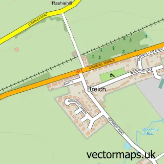
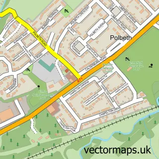
This Bents street map is a detailed vector street map covering a 750m x 750m area. Select a larger area to create and download your own vector street map of Bents.

Bents is a village in West Lothian, in the Lothian of Scotland. The settlement falls within the Livingston parliamentary constituency. It is served by the EH47 postcode district, with EH47 8 as the local postcode sector.

The 750-metre map sample for Bents covers 219 mapped buildings and approximately 7.7 km of road detail, of which 19 named roads are named. The immediate area includes 3 MOT stations within 2 miles. To create a larger or custom map of Bents, the map builder lets you define your own coverage area and download editable SVG, PDF and PNG files.

219Buildings
7.7 kmRoads
19Named roads
0Residents within 2 miles
Create your own

Create a larger editable map of Bents

Choose any area you need and generate a high-quality vector map instantly. Perfect for print, planning, design, business and personal use.

Choose any location
Editable SVG files
Any size up to A0
PDF, PNG & more
Instant download
High quality guaranteed
Create My Custom Map
Secure, private & no credit card required
Bents Vector Street Map
750m Sample
Bents vector street map sample showing roads, buildings and local features in a 750 metre preview area
Buy Bents Map Print from £12.95 Buy Bents Digital Map from £6

This Bents street map in West Lothian is available as downloadable SVG, PDF and PNG map files, or as a printed map for planning, business, display, education, local information and design work. You can also create a larger custom map area using the map selector.

What this Bents map sample shows

Bents lies within West Lothian parish, part of Fauldhouse And The Breich Valley ward in the West Lothian local authority area. The postcode geography for this area includes the EH postcode area, the EH47 postcode district and the EH47 8 postcode sector. Residents fall under the Lothian for NHS services.

Local features near Bents

Within 2 miles

Amenities and services in and around Bents.

3 MOT stations within 2 miles

Counts are approximate and based on publicly available data.

Administrative and postcode information for Bents

Bents lies within West Lothian parish, part of Fauldhouse And The Breich Valley ward in the West Lothian local authority area. The postcode geography for this area includes the EH postcode area, the EH47 postcode district and the EH47 8 postcode sector. Residents fall under the Lothian for NHS services.

Parish WEST LOTHIAN
Ward Fauldhouse and the Breich Valley
District / local authority West Lothian
County West Lothian
Historic county West Lothian
Postcode district EH47
Postcode sector EH47 8
Parliamentary constituency Livingston
Region Lothian
Country Scotland

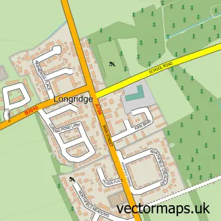
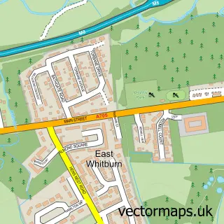
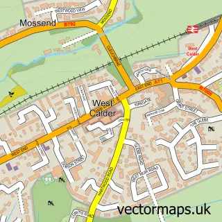
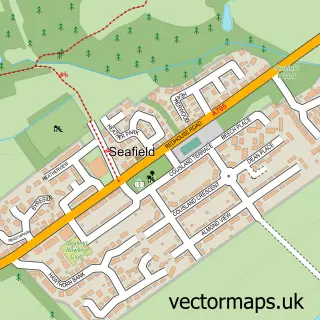
Nearby street map samples around Bents

Street map sample of Blackburn, West Lothian Blackburn Town - West Lothian - 2.0 miles Street map sample of Dunfermline, Fife Dunfermline City - Fife - 17.2 miles Street map sample of Stoneyburn, West Lothian Stoneyburn Village - West Lothian - 0.6 miles Street map sample of Addiewell, West Lothian Addiewell Village - West Lothian - 0.8 miles Street map sample of Breich, West Lothian Breich Village - West Lothian - 1.2 miles Street map sample of Longridge, West Lothian Longridge Village - West Lothian - 1.4 miles Street map sample of East Whitburn, West Lothian East Whitburn Village - West Lothian - 1.9 miles Street map sample of West Calder, West Lothian West Calder Village - West Lothian - 2.7 miles Street map sample of Seafield, West Lothian Seafield Village - West Lothian - 3.1 miles Street map sample of Polbeth, West Lothian Polbeth Village - West Lothian - 3.5 miles

More street maps in West Lothian

Street map sample of Stoneyburn, West Lothian Stoneyburn Village - 0.6 miles Street map sample of Addiewell, West Lothian Addiewell Village - 0.8 miles Street map sample of Breich, West Lothian Breich Village - 1.2 miles Street map sample of Longridge, West Lothian Longridge Village - 1.4 miles Street map sample of East Whitburn, West Lothian East Whitburn Village - 1.9 miles

750 metre map area coverage

Boundary, postcode and point of interest information for the 750m x 750m rectangle centred on this sample map.

Boundaries containing map centre

Constituency: Livingston Co Const

District: West Lothian

Icb: Lothian

Postcode District: EH47

Postcode Sector: EH47 8

Ward: Fauldhouse and the Breich Valley Ward

Nearby boundaries intersecting sample

Postcode District: EH55

Postcode Sector: EH55 8

Postcode coverage

EH47 EH47 8 EH55 EH55 8

POI category counts

Convenience Store: 2

Bar And Grill Restaurant: 1

Courier And Delivery Services: 1

Elementary School: 1

Engine Repair Service: 1

Grocery Store: 1

Package Locker: 1

Pet Groomer: 1

Physical Therapy: 1

Rental Kiosks: 1

Sample points of interest

  • leelee's Bar And Grill. Bar And Grill Restaurant
  • One Stop Convenience Store
  • One Stop Convenience Store
  • Evri ParcelShop Courier And Delivery Services
  • Our Lady's RC Primary School Elementary School
  • D & M Cleaning Services Engine Repair Service
  • Day to Day Grocery Store
  • InPost Package Locker
  • The Dog House Pet Groomer
  • BB Bodyworks and Botanicals Physical Therapy
  • Costa Express Rental Kiosks
  • Swim-It Sports And Recreation Venue

Create a larger editable map of Bents

This sample shows only a 750 metre area. To create a larger map of Bents, use our map builder to choose your own coverage area, add titles and download editable SVG, PDF and PNG files.

Create a custom map of Bents

Phone 01751 473136 | Copyright Vectormaps.uk 2026

Samples Customizer Privacy Disclaimer
Bents Vector Street Map
Bents enlarged street map sample showing a 750 metre preview area