Vector Maps logo
Home Why it works Popular maps Districts Samples Customizer Create Your Map
VectorMaps.uk
Home Popular maps Districts Samples Customizer Create Your Map Privacy Disclaimer
Home / UK Maps / East Riding of Yorkshire / Beverley Map

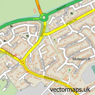
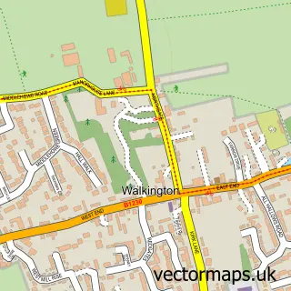
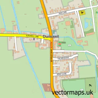
This Beverley street map is a detailed vector street map covering a 750m x 750m area. Select a larger area to create and download your own vector street map of Beverley.

Beverley is a town in East Riding Of Yorkshire, in the Yorkshire And The Humber of England. Historically, the area formed part of Yorkshire. The settlement falls within the Beverley And Holderness parliamentary constituency. It is served by the HU17 postc

The 750-metre map sample for Beverley covers 394 mapped buildings and approximately 21.5 km of road detail, of which 76 named roads are named. The immediate area includes 1 school, 2 GP surgeries, with 4 within 2 miles, 22 pubs and 2 MOT stations, with 13 within 2 miles. The wider area around Beverley features 7 tourism points of interest, 57 food and drink venues and 7 hotels. To create a larger or custom map of Beverley, the map builder lets you define your own coverage area and download editable SVG, PDF and PNG files.

394Buildings
21.54 kmRoads
76Named roads
15,205Residents within 2 miles
Create your own

Create a larger editable map of Beverley

Choose any area you need and generate a high-quality vector map instantly. Perfect for print, planning, design, business and personal use.

Choose any location
Editable SVG files
Any size up to A0
PDF, PNG & more
Instant download
High quality guaranteed
Create My Custom Map
Secure, private & no credit card required
Beverley Vector Street Map
750m Sample
Beverley vector street map sample showing roads, buildings and local features in a 750 metre preview area
Buy Beverley Map Print from £12.95 Buy Beverley Digital Map from £6

This Beverley street map in East Riding of Yorkshire is available as downloadable SVG, PDF and PNG map files, or as a printed map for planning, business, display, education, local information and design work. You can also create a larger custom map area using the map selector.

What this Beverley map sample shows

Beverley lies within Beverley Cp parish, part of Minster And Woodmansey ward in the East Riding Of Yorkshire local authority area. The postcode geography for this area includes the HU postcode area, the HU17 postcode district and the HU17 0 postcode sector. Residents fall under the Nhs Humber And North Yorkshire Integrated Care Board for NHS services.

Local features near Beverley

Within 2 miles

Amenities and services in and around Beverley.

1 Schools
1 Campsites within 2 miles
2 GP surgeries 4 within 2 miles
2 MOT stations 13 within 2 miles
7 Tourism & leisure
57 Food & drink
22 Pubs
7 Hotels
16 Healthcare POIs
7 Vehicle services

Counts are approximate and based on publicly available data.

Administrative and postcode information for Beverley

Beverley lies within Beverley Cp parish, part of Minster And Woodmansey ward in the East Riding Of Yorkshire local authority area. The postcode geography for this area includes the HU postcode area, the HU17 postcode district and the HU17 0 postcode sector. Residents fall under the Nhs Humber And North Yorkshire Integrated Care Board for NHS services.

Parish Beverley CP
Ward Minster and Woodmansey
District / local authority East Riding of Yorkshire
County East Riding of Yorkshire
Historic county Yorkshire
Postcode district HU17
Postcode sector HU17 0
Parliamentary constituency Beverley and Holderness
Region Yorkshire and the Humber
Country England

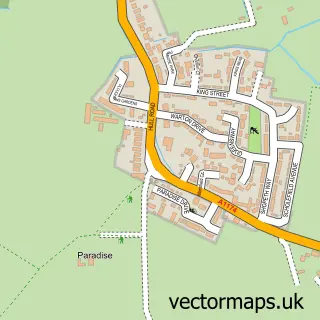
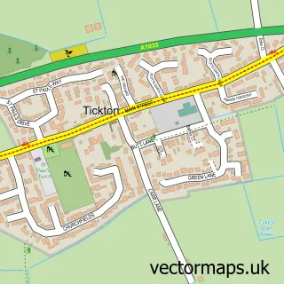
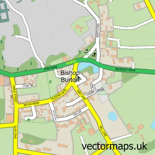
Nearby street map samples around Beverley

Street map sample of Hull, East Riding of Yorkshire Hull City - East Riding of Yorkshire - 7.8 miles Street map sample of Molescroft, East Riding of Yorkshire Molescroft Village - East Riding of Yorkshire - 1.0 miles Street map sample of Woodmansey, East Riding of Yorkshire Woodmansey Village - East Riding of Yorkshire - 1.7 miles Street map sample of Tickton, East Riding of Yorkshire Tickton Village - East Riding of Yorkshire - 2.4 miles Street map sample of Bishop Burton, East Riding of Yorkshire Bishop Burton Village - East Riding of Yorkshire - 2.7 miles Street map sample of Walkington, East Riding of Yorkshire Walkington Village - East Riding of Yorkshire - 2.7 miles Street map sample of Leconfield, East Riding of Yorkshire Leconfield Village - East Riding of Yorkshire - 2.7 miles Street map sample of Cherry Burton, East Riding of Yorkshire Cherry Burton Village - East Riding of Yorkshire - 3.2 miles Street map sample of Scorborough, East Riding of Yorkshire Scorborough Village - East Riding of Yorkshire - 3.7 miles Street map sample of Dunswell, East Riding of Yorkshire Dunswell Village - East Riding of Yorkshire - 3.8 miles

More street maps in East Riding of Yorkshire

Street map sample of Molescroft, East Riding of Yorkshire Molescroft Village - 1.0 miles Street map sample of Woodmansey, East Riding of Yorkshire Woodmansey Village - 1.7 miles Street map sample of Tickton, East Riding of Yorkshire Tickton Village - 2.4 miles Street map sample of Bishop Burton, East Riding of Yorkshire Bishop Burton Village - 2.7 miles Street map sample of Walkington, East Riding of Yorkshire Walkington Village - 2.7 miles

750 metre map area coverage

Boundary, postcode and point of interest information for the 750m x 750m rectangle centred on this sample map.

Boundaries containing map centre

Constituency: Beverley and Holderness Co Const

District: East Riding of Yorkshire

Icb: NHS Humber and North Yorkshire ICB

Parish: Beverley CP

Police Force: humberside

Postcode District: HU17

Postcode Sector: HU17 8

Ward: St. Mary's Ward

Nearby boundaries intersecting sample

Postcode Sector: HU17 0, HU17 7, HU17 9

Ward: Minster and Woodmansey Ward

Postcode coverage

HU17 HU17 8 HU17 0 HU17 7 HU17 9

POI category counts

Clothing Store: 30

Hair Salon: 24

Pub: 22

Beauty Salon: 21

Cafe: 17

Charity Organization: 13

Real Estate Agent: 13

Barber: 12

Bakery: 11

Flowers And Gifts Shop: 11

Sample points of interest

  • Beverly City Centre Accommodation
  • Finnies Accountants Accountant
  • Finnies Ltd. Accountant
  • Phoenix Accountancy and Business Consultancy Accountant
  • TC Group - East Yorkshire Accountant
  • Beverley Acupuncture Centre Acupuncture
  • Herbgarden Acupuncture
  • Communique Advertising Advertising Agency
  • Everything But the Product Advertising Agency
  • The J M P Partnership Advertising Agency
  • Warner Leach Advertising Agency
  • White Agency Advertising Agency

Create a larger editable map of Beverley

This sample shows only a 750 metre area. To create a larger map of Beverley, use our map builder to choose your own coverage area, add titles and download editable SVG, PDF and PNG files.

Create a custom map of Beverley

Phone 01751 473136 | Copyright Vectormaps.uk 2026

Samples Customizer Privacy Disclaimer
Beverley Vector Street Map
Beverley enlarged street map sample showing a 750 metre preview area