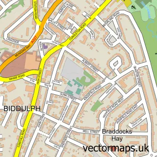
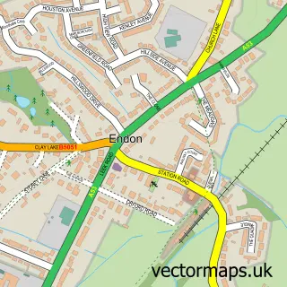
This Biddulph Moor street map is a detailed vector street map covering a 750m x 750m area. Select a larger area to create and download your own vector street map of Biddulph Moor.
The 750-metre map sample for Biddulph Moor covers 501 mapped buildings and approximately 16.4 km of road detail, of which 30 named roads are named. The immediate area includes 1 school, 2 GP surgeries within 2 miles, 1 pub and 1 MOT station, with 4 within 2 miles. The wider area around Biddulph Moor features 2 tourism points of interest and 1 food and drink venue. To create a larger or custom map of Biddulph Moor, the map builder lets you define your own coverage area and download editable SVG, PDF and PNG files.
Create a larger editable map of Biddulph Moor
Choose any area you need and generate a high-quality vector map instantly. Perfect for print, planning, design, business and personal use.

This Biddulph Moor street map in Staffordshire is available as downloadable SVG, PDF and PNG map files, or as a printed map for planning, business, display, education, local information and design work. You can also create a larger custom map area using the map selector.
What this Biddulph Moor map sample shows
Biddulph Moor lies within Biddulph Cp parish, part of Biddulph Moor ward in the Staffordshire Moorlands District local authority area. The postcode geography for this area includes the ST postcode area, the ST8 postcode district and the ST8 7 postcode sector. Residents fall under the Nhs Staffordshire And Stoke-On-Trent Integrated Care Board for NHS services.
Local features near Biddulph Moor
Within 2 milesAmenities and services in and around Biddulph Moor.
Administrative and postcode information for Biddulph Moor
The local authority covering Biddulph Moor is Staffordshire Moorlands District, within the county of Staffordshire. The settlement lies within Biddulph Moor ward and Biddulph Cp civil parish. The ST8 postcode district and ST8 7 postcode sector serve the immediate area. NHS provision in the area is delivered through University Hospitals Of North Midlands Nhs Trust.
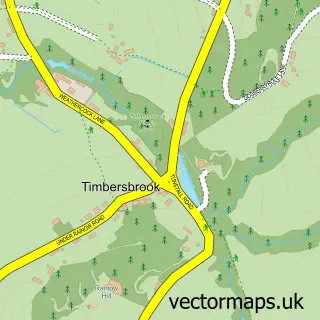
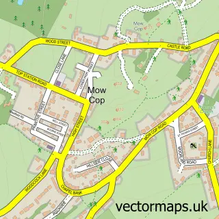
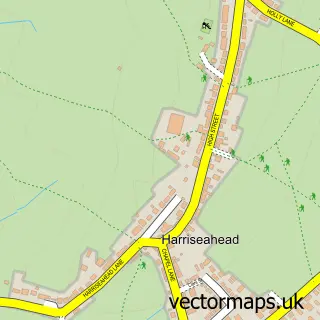
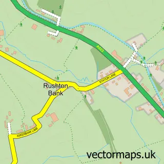
Nearby street map samples around Biddulph Moor

More street maps in Staffordshire
750 metre map area coverage
Boundary, postcode and point of interest information for the 750m x 750m rectangle centred on this sample map.
Boundaries containing map centre
Constituency: Staffordshire Moorlands Co Const
County: Staffordshire County
District: Staffordshire Moorlands District
Icb: NHS Staffordshire and Stoke-on-Trent ICB
Parish: Biddulph CP
Police Force: staffordshire
Postcode District: ST8
Postcode Sector: ST8 7
Ward: Biddulph Moor Ward
Nearby boundaries intersecting sample
Ward: Biddulph North Ward
Postcode coverage
POI category counts
Church Cathedral: 2
Convenience Store: 2
Korean Grocery Store: 2
Anglican Church: 1
Beauty And Spa: 1
Community Center: 1
Courier And Delivery Services: 1
Currency Exchange: 1
Elementary School: 1
Furniture Store: 1
Sample points of interest
- Christ Church Biddulph Moor
- Caroline at Barn Farm Tropic Skincare & Makeup
- Hill Top Methodist Church
- New Road Methodist Church
- Biddulph Moor Village Hall
- SPAR Biddulph Moor
- Spar
- Avante Express
- Post Office Travel Money
- Moor County First School
- CBS Windows
- P Tinsley & Son
Create a larger editable map of Biddulph Moor
This sample shows only a 750 metre area. To create a larger map of Biddulph Moor, use our map builder to choose your own coverage area, add titles and download editable SVG, PDF and PNG files.
Create a custom map of Biddulph Moor