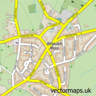
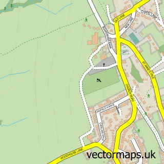
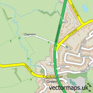
This Biddulph street map is a detailed vector street map covering a 750m x 750m area. Select a larger area to create and download your own vector street map of Biddulph.
The 750-metre map sample for Biddulph covers 552 mapped buildings and approximately 21.4 km of road detail, of which 50 named roads are named. The immediate area includes 1 school, 2 GP surgeries, 7 pubs and 1 MOT station, with 6 within 2 miles. The wider area around Biddulph features 1 tourism point of interest, 11 food and drink venues and 1 hotel. To create a larger or custom map of Biddulph, the map builder lets you define your own coverage area and download editable SVG, PDF and PNG files.
Create a larger editable map of Biddulph
Choose any area you need and generate a high-quality vector map instantly. Perfect for print, planning, design, business and personal use.

This Biddulph street map in Staffordshire is available as downloadable SVG, PDF and PNG map files, or as a printed map for planning, business, display, education, local information and design work. You can also create a larger custom map area using the map selector.
What this Biddulph map sample shows
Biddulph lies within Biddulph Cp parish, part of Biddulph West ward in the Staffordshire Moorlands District local authority area. The postcode geography for this area includes the ST postcode area, the ST8 postcode district and the ST8 6 postcode sector. Residents fall under the Nhs Staffordshire And Stoke-On-Trent Integrated Care Board for NHS services.
Local features near Biddulph
Within 2 milesAmenities and services in and around Biddulph.
Administrative and postcode information for Biddulph
Biddulph lies within Biddulph Cp parish, part of Biddulph West ward in the Staffordshire Moorlands District local authority area. The postcode geography for this area includes the ST postcode area, the ST8 postcode district and the ST8 6 postcode sector. Residents fall under the Nhs Staffordshire And Stoke-On-Trent Integrated Care Board for NHS services.
Nearby street map samples around Biddulph

More street maps in Staffordshire
750 metre map area coverage
Boundary, postcode and point of interest information for the 750m x 750m rectangle centred on this sample map.
Boundaries containing map centre
Constituency: Staffordshire Moorlands Co Const
County: Staffordshire County
District: Staffordshire Moorlands District
Icb: NHS Staffordshire and Stoke-on-Trent ICB
Parish: Biddulph CP
Police Force: staffordshire
Postcode District: ST8
Postcode Sector: ST8 6
Ward: Biddulph East Ward
Nearby boundaries intersecting sample
Postcode Sector: ST8 7
Ward: Biddulph North Ward, Biddulph West Ward
Postcode coverage
POI category counts
Hair Salon: 10
Beauty Salon: 8
Flowers And Gifts Shop: 7
Pub: 7
Barber: 6
Chinese Restaurant: 6
Pharmacy: 6
Automotive Repair: 5
Real Estate Agent: 5
Advertising Agency: 4
Sample points of interest
- P Y R
- STRIVAAL - Internet Marketing
- StrivaaL
- Vemedia
- Alan Finney Antiques
- British Red Cross
- B D S
- Biddulph Domestic Services
- In2sewingmachines
- bp Architecture
- John Arnold Galleries
- The Wool Shop
Create a larger editable map of Biddulph
This sample shows only a 750 metre area. To create a larger map of Biddulph, use our map builder to choose your own coverage area, add titles and download editable SVG, PDF and PNG files.
Create a custom map of Biddulph