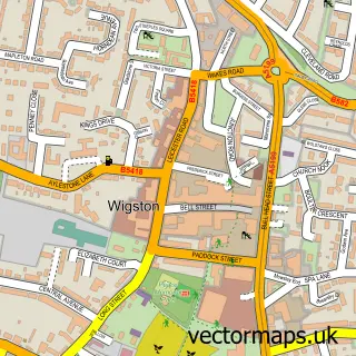
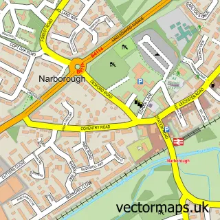
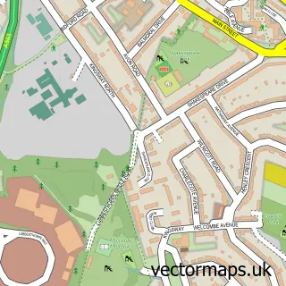
This Blaby street map is a detailed vector street map covering a 750m x 750m area. Select a larger area to create and download your own vector street map of Blaby.
The 750-metre map sample for Blaby covers 508 mapped buildings and approximately 33.2 km of road detail, of which 37 named roads are named. The immediate area includes 1 school, 1 GP surgery, with 7 within 2 miles, 7 pubs and 1 MOT station, with 13 within 2 miles. The wider area around Blaby features 3 tourism points of interest and 12 food and drink venues. To create a larger or custom map of Blaby, the map builder lets you define your own coverage area and download editable SVG, PDF and PNG files.
Create a larger editable map of Blaby
Choose any area you need and generate a high-quality vector map instantly. Perfect for print, planning, design, business and personal use.

This Blaby street map in Leicestershire is available as downloadable SVG, PDF and PNG map files, or as a printed map for planning, business, display, education, local information and design work. You can also create a larger custom map area using the map selector.
What this Blaby map sample shows
Blaby lies within Blaby Cp parish, part of Blaby South ward in the Blaby District local authority area. The postcode geography for this area includes the LE postcode area, the LE8 postcode district and the LE8 4 postcode sector. Residents fall under the Nhs Leicester, Leicestershire And Rutland Integrated Care Board for NHS services.
Local features near Blaby
Within 2 milesAmenities and services in and around Blaby.
Administrative and postcode information for Blaby
The local authority covering Blaby is Blaby District, within the county of Leicestershire. The settlement lies within Blaby South ward and Blaby Cp civil parish. The LE8 postcode district and LE8 4 postcode sector serve the immediate area. NHS provision in the area is delivered through University Hospitals Of Leicester Nhs Trust.
Nearby street map samples around Blaby

More street maps in Leicestershire
750 metre map area coverage
Boundary, postcode and point of interest information for the 750m x 750m rectangle centred on this sample map.
Boundaries containing map centre
Constituency: South Leicestershire Co Const
County: Leicestershire County
District: Blaby District
Icb: NHS Leicester Leicestershire and Rutland ICB
Parish: Blaby CP
Police Force: leicestershire
Postcode District: LE8
Postcode Sector: LE8 4
Ward: Blaby Ward
Nearby boundaries intersecting sample
Ward: North Whetstone Ward
Postcode coverage
POI category counts
Hair Salon: 9
Real Estate Agent: 9
Beauty Salon: 8
Pub: 7
Contractor: 5
Beauty And Spa: 4
Building Supply Store: 4
Church Cathedral: 4
Financial Service: 4
Jewelry Store: 4
Sample points of interest
- Claire Norton Acupuncture
- Han Acuherbs
- CliniSolutions Ltd
- Blaby: All Saints
- Blaby Antiques Centre
- Secret Vintage
- Sedgeleys Television Video & Radio Servicing
- Trinkets & Trouble
- Blaby Drop in Centre
- Morrisons Daily - Leicester Blaby Forge Cor
- Blaby Allotments
- BMS Motorbitz LTD
Create a larger editable map of Blaby
This sample shows only a 750 metre area. To create a larger map of Blaby, use our map builder to choose your own coverage area, add titles and download editable SVG, PDF and PNG files.
Create a custom map of Blaby