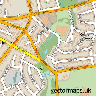
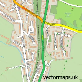
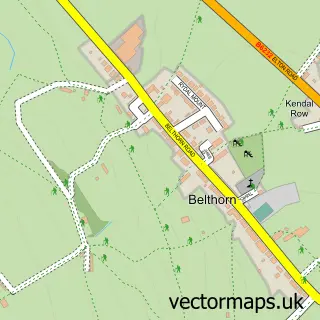
This Blackburn street map is a detailed vector street map covering a 750m x 750m area. Select a larger area to create and download your own vector street map of Blackburn.
The 750-metre map sample for Blackburn covers 187 mapped buildings and approximately 26.8 km of road detail, of which 73 named roads are named. The immediate area includes 3 schools, 1 railway station, 3 GP surgeries, with 18 within 2 miles and 13 pubs among other local services. The wider area around Blackburn features 6 tourism points of interest, 60 food and drink venues and 5 hotels. To create a larger or custom map of Blackburn, the map builder lets you define your own coverage area and download editable SVG, PDF and PNG files.
Create a larger editable map of Blackburn
Choose any area you need and generate a high-quality vector map instantly. Perfect for print, planning, design, business and personal use.

This Blackburn street map in Lancashire is available as downloadable SVG, PDF and PNG map files, or as a printed map for planning, business, display, education, local information and design work. You can also create a larger custom map area using the map selector.
What this Blackburn map sample shows
Blackburn lies within Blackburn With Darwen (B) parish, part of Blackburn Central ward in the Blackburn With Darwen (B) local authority area. The postcode geography for this area includes the BB postcode area, the BB2 postcode district and the BB2 1 postcode sector. Residents fall under the Nhs Lancashire And South Cumbria Integrated Care Board for NHS services.
Local features near Blackburn
Within 2 milesAmenities and services in and around Blackburn.
Administrative and postcode information for Blackburn
Blackburn lies within Blackburn With Darwen (B) parish, part of Blackburn Central ward in the Blackburn With Darwen (B) local authority area. The postcode geography for this area includes the BB postcode area, the BB2 postcode district and the BB2 1 postcode sector. Residents fall under the Nhs Lancashire And South Cumbria Integrated Care Board for NHS services.
Nearby street map samples around Blackburn

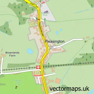
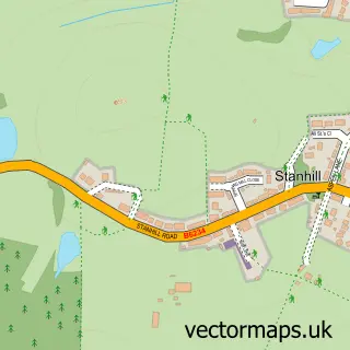
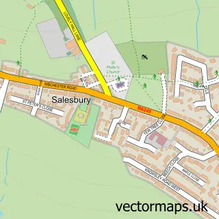
More street maps in Lancashire
750 metre map area coverage
Boundary, postcode and point of interest information for the 750m x 750m rectangle centred on this sample map.
Boundaries containing map centre
Constituency: Blackburn Boro Const
District: Blackburn with Darwen (B)
Icb: NHS Lancashire and South Cumbria ICB
Police Force: lancashire
Postcode District: BB1
Postcode Sector: BB1 7
Ward: Blackburn Central Ward
Nearby boundaries intersecting sample
Postcode District: BB2
Postcode Sector: BB1 1, BB1 5, BB1 6, BB1 8, BB2 1, BB2 2
Ward: Shear Brow & Corporation Park Ward, Wensley Fold Ward
Postcode coverage
POI category counts
Hair Salon: 28
Restaurant: 25
Clothing Store: 24
Fast Food Restaurant: 23
Beauty Salon: 22
Charity Organization: 20
Jewelry Store: 20
Professional Services: 19
Lawyer: 17
Cafe: 16
Sample points of interest
- AA Accountax Ltd
- Beever And Struthers
- Holroyd Accountant Services Ltd.
- Howard & Co. Chartered Accountants
- McManus Accounting
- Pervaiz & Co
- Pierce
- RIC Accountancy Services
- Ridehalgh Accountants
- TaxAssist Accountants
- TaxAttack Blackburn Management & Accounting
- Holker House
Create a larger editable map of Blackburn
This sample shows only a 750 metre area. To create a larger map of Blackburn, use our map builder to choose your own coverage area, add titles and download editable SVG, PDF and PNG files.
Create a custom map of Blackburn