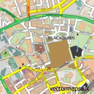
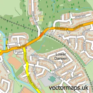
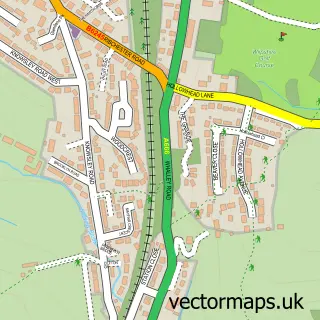
This Knuzden Brook street map is a detailed vector street map covering a 750m x 750m area. Select a larger area to create and download your own vector street map of Knuzden Brook.
The 750-metre map sample for Knuzden Brook covers 479 mapped buildings and approximately 21.6 km of road detail, of which 41 named roads are named. The immediate area includes 1 school, 15 GP surgeries within 2 miles, 4 pubs and 36 MOT stations within 2 miles. The wider area around Knuzden Brook features 1 tourism point of interest and 6 food and drink venues. To create a larger or custom map of Knuzden Brook, the map builder lets you define your own coverage area and download editable SVG, PDF and PNG files.
Create a larger editable map of Knuzden Brook
Choose any area you need and generate a high-quality vector map instantly. Perfect for print, planning, design, business and personal use.

This Knuzden Brook street map in Lancashire is available as downloadable SVG, PDF and PNG map files, or as a printed map for planning, business, display, education, local information and design work. You can also create a larger custom map area using the map selector.
What this Knuzden Brook map sample shows
Knuzden Brook lies within Lancashire County parish, part of St Andrew's ward in the Hyndburn District (B) local authority area. The postcode geography for this area includes the BB postcode area, the BB5 postcode district and the BB5 3 postcode sector. Residents fall under the Nhs Lancashire And South Cumbria Integrated Care Board for NHS services.
Local features near Knuzden Brook
Within 2 milesAmenities and services in and around Knuzden Brook.
Administrative and postcode information for Knuzden Brook
The local authority covering Knuzden Brook is Hyndburn District (B), within the county of Lancashire. The settlement lies within St Andrew's ward and Lancashire County civil parish. The BB5 postcode district and BB5 3 postcode sector serve the immediate area. NHS provision in the area is delivered through East Lancashire Hospitals Nhs Trust.
Nearby street map samples around Knuzden Brook

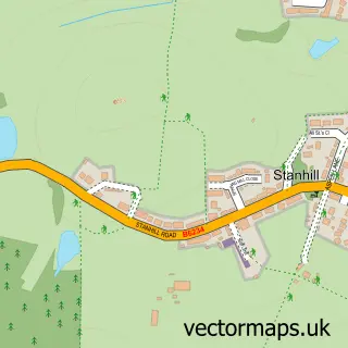
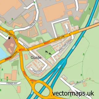
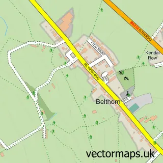
More street maps in Lancashire

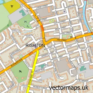
750 metre map area coverage
Boundary, postcode and point of interest information for the 750m x 750m rectangle centred on this sample map.
Boundaries containing map centre
District: Blackburn with Darwen (B)
Icb: NHS Lancashire and South Cumbria ICB
Police Force: lancashire
Postcode District: BB1
Postcode Sector: BB1 2
Ward: Blackburn South East Ward
Nearby boundaries intersecting sample
Constituency: Blackburn Boro Const, Hyndburn Co Const
County: Lancashire County
District: Hyndburn District (B)
Postcode Sector: BB1 3
Ward: Audley & Queen's Park Ward, Little Harwood & Whitebirk Ward, Rishton Ward, St. Oswald's Ward
Postcode coverage
POI category counts
Convenience Store: 8
Professional Services: 5
Pub: 4
Car Dealer: 3
Automotive Repair: 2
Building Supply Store: 2
Community Center: 2
Personal Care Service: 2
Pizza Restaurant: 2
Retail: 2
Sample points of interest
- St Oswald's Church Knuzden
- Intack motor services
- Vass Motorsport Garage Repair Specialist
- Forester's
- William Hill
- Wright's Bites
- Deluxe Diamond Products
- Lanzet
- Blackburn Bus Company
- Master Wok
- BCC Suzuki Blackburn
- Chapelhouse Suzuki
Create a larger editable map of Knuzden Brook
This sample shows only a 750 metre area. To create a larger map of Knuzden Brook, use our map builder to choose your own coverage area, add titles and download editable SVG, PDF and PNG files.
Create a custom map of Knuzden Brook