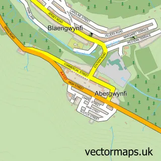
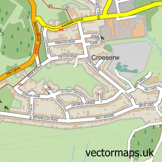
This Blaengarw street map is a detailed vector street map covering a 750m x 750m area. Select a larger area to create and download your own vector street map of Blaengarw.
The 750-metre map sample for Blaengarw covers 147 mapped buildings and approximately 9.2 km of road detail, of which 26 named roads are named. The immediate area includes 1 school, 2 pubs and 1 MOT station within 2 miles. The wider area around Blaengarw features 1 tourism point of interest and 3 food and drink venues. To create a larger or custom map of Blaengarw, the map builder lets you define your own coverage area and download editable SVG, PDF and PNG files.
Create a larger editable map of Blaengarw
Choose any area you need and generate a high-quality vector map instantly. Perfect for print, planning, design, business and personal use.

This Blaengarw street map in Mid Glamorgan is available as downloadable SVG, PDF and PNG map files, or as a printed map for planning, business, display, education, local information and design work. You can also create a larger custom map area using the map selector.
What this Blaengarw map sample shows
Blaengarw lies within Garw Valley Community parish, part of Blaengarw ward in the Pen-Y-Bont Ar Ogwr - Bridgend local authority area. The postcode geography for this area includes the CF postcode area, the CF32 postcode district and the CF32 8 postcode sector. Residents fall under the Swansea Bay University Local Health Board for NHS services.
Local features near Blaengarw
Within 2 milesAmenities and services in and around Blaengarw.
Administrative and postcode information for Blaengarw
The local authority covering Blaengarw is Pen-Y-Bont Ar Ogwr - Bridgend, within the county of Mid Glamorgan. The settlement lies within Blaengarw ward and Garw Valley Community civil parish. The CF32 postcode district and CF32 8 postcode sector serve the immediate area. NHS provision in the area is delivered through Cwm Taf Morgannwg University Health Board.
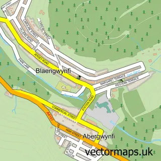
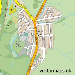
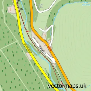
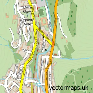
Nearby street map samples around Blaengarw

More street maps in Mid Glamorgan
750 metre map area coverage
Boundary, postcode and point of interest information for the 750m x 750m rectangle centred on this sample map.
Boundaries containing map centre
Constituency: Rhondda and Ogmore Co Const
District: Pen-y-bont ar Ogwr - Bridgend
Icb: Abertawe Bro Morgannwg University
Parish: Garw Valley Community
Police Force: south wales
Postcode District: CF32
Postcode Sector: CF32 8
Nearby boundaries intersecting sample
No additional intersecting boundaries found.
Postcode coverage
POI category counts
Active Life: 2
Parking: 2
Pub: 2
Shipping Center: 2
Atms: 1
Bar: 1
Cafe: 1
Church Cathedral: 1
Community Center: 1
Cultural Center: 1
Sample points of interest
- Bryntirion & Laleston Community Centre - LCC
- Darren Fawr - Garw Valley Mountain Bike Trails
- ATM (Post Office)
- Blaengarw Working Mens Club
- Garw Valley Cafe
- Garw Valley Links Community Church
- Creation Development Trust
- Creation Community Development Ltd.
- Wexa
- Blaengarw Primary School
- The Real Food Box and Shop
- Fudgey's Gym
Create a larger editable map of Blaengarw
This sample shows only a 750 metre area. To create a larger map of Blaengarw, use our map builder to choose your own coverage area, add titles and download editable SVG, PDF and PNG files.
Create a custom map of Blaengarw