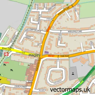
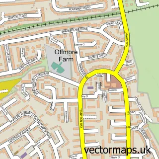
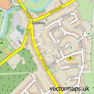
This Blakedown street map is a detailed vector street map covering a 750m x 750m area. Select a larger area to create and download your own vector street map of Blakedown.
The 750-metre map sample for Blakedown covers 312 mapped buildings and approximately 36.0 km of road detail, of which 19 named roads are named. The immediate area includes 1 school, 1 railway station, 1 GP surgery within 2 miles and 2 pubs. The wider area around Blakedown features 4 tourism points of interest, 2 food and drink venues and 1 hotel. To create a larger or custom map of Blakedown, the map builder lets you define your own coverage area and download editable SVG, PDF and PNG files.
Create a larger editable map of Blakedown
Choose any area you need and generate a high-quality vector map instantly. Perfect for print, planning, design, business and personal use.

This Blakedown street map in Worcestershire is available as downloadable SVG, PDF and PNG map files, or as a printed map for planning, business, display, education, local information and design work. You can also create a larger custom map area using the map selector.
What this Blakedown map sample shows
Blakedown lies within Churchill And Blakedown Cp parish, part of Wyre Forest Rural ward in the Wyre Forest District local authority area. The postcode geography for this area includes the DY postcode area, the DY10 postcode district and the DY10 3 postcode sector. Residents fall under the Nhs Herefordshire And Worcestershire Integrated Care Board for NHS services.
Local features near Blakedown
Within 2 milesAmenities and services in and around Blakedown.
Administrative and postcode information for Blakedown
Blakedown lies within Churchill And Blakedown Cp parish, part of Wyre Forest Rural ward in the Wyre Forest District local authority area. The postcode geography for this area includes the DY postcode area, the DY10 postcode district and the DY10 3 postcode sector. Residents fall under the Nhs Herefordshire And Worcestershire Integrated Care Board for NHS services.
Nearby street map samples around Blakedown

More street maps in Worcestershire
750 metre map area coverage
Boundary, postcode and point of interest information for the 750m x 750m rectangle centred on this sample map.
Boundaries containing map centre
Constituency: Wyre Forest Co Const
County: Worcestershire County
District: Wyre Forest District
Icb: NHS Herefordshire and Worcestershire ICB
Parish: Churchill and Blakedown CP
Police Force: west mercia
Postcode District: DY10
Postcode Sector: DY10 3
Ward: Wyre Forest Rural Ward
Nearby boundaries intersecting sample
No additional intersecting boundaries found.
Postcode coverage
POI category counts
Beauty Salon: 6
Antique Store: 2
Building Supply Store: 2
Elementary School: 2
Hair Salon: 2
Industrial Equipment: 2
Landmark And Historical Building: 2
Pub: 2
Sports Club And League: 2
Train Station: 2
Sample points of interest
- The church of St James the Great Blakedown
- John Hubbard Antiques & Restoration
- John Hubbard Antiques & Restoration
- InstaVolt Charging Station
- Beauty babes HQ
- Blondes By Kayleigh
- JLS Aesthetics
- Sally Hair and Beauty
- The Beauty Room
- The Lash Lounge & Beauty
- Diamond Fibreglass
- Rook Services Ltd
Create a larger editable map of Blakedown
This sample shows only a 750 metre area. To create a larger map of Blakedown, use our map builder to choose your own coverage area, add titles and download editable SVG, PDF and PNG files.
Create a custom map of Blakedown