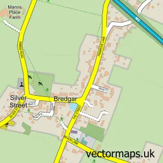
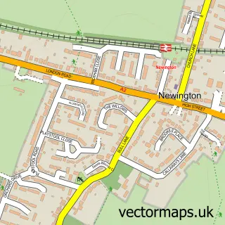
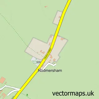
This Borden street map is a detailed vector street map covering a 750m x 750m area. Select a larger area to create and download your own vector street map of Borden.
The 750-metre map sample for Borden covers 185 mapped buildings and approximately 6.2 km of road detail, of which 9 named roads are named. The immediate area includes 5 GP surgeries within 2 miles, 1 pub and 13 MOT stations within 2 miles. The wider area around Borden features 2 tourism points of interest and 1 food and drink venue. To create a larger or custom map of Borden, the map builder lets you define your own coverage area and download editable SVG, PDF and PNG files.
Create a larger editable map of Borden
Choose any area you need and generate a high-quality vector map instantly. Perfect for print, planning, design, business and personal use.

This Borden street map in Kent is available as downloadable SVG, PDF and PNG map files, or as a printed map for planning, business, display, education, local information and design work. You can also create a larger custom map area using the map selector.
What this Borden map sample shows
Borden lies within Borden Cp parish, part of Borden And Grove Park ward in the Swale District (B) local authority area. The postcode geography for this area includes the ME postcode area, the ME9 postcode district and the ME9 8 postcode sector. Residents fall under the Nhs Kent And Medway Integrated Care Board for NHS services.
Local features near Borden
Within 2 milesAmenities and services in and around Borden.
Administrative and postcode information for Borden
Borden lies within Borden Cp parish, part of Borden And Grove Park ward in the Swale District (B) local authority area. The postcode geography for this area includes the ME postcode area, the ME9 postcode district and the ME9 8 postcode sector. Residents fall under the Nhs Kent And Medway Integrated Care Board for NHS services.
Nearby street map samples around Borden

More street maps in Kent
750 metre map area coverage
Boundary, postcode and point of interest information for the 750m x 750m rectangle centred on this sample map.
Boundaries containing map centre
Constituency: Sittingbourne and Sheppey Co Const
County: Kent County
District: Swale District (B)
Icb: NHS Kent and Medway ICB
Parish: Borden CP
Police Force: kent
Postcode District: ME9
Postcode Sector: ME9 8
Ward: Borden and Grove Park Ward
Nearby boundaries intersecting sample
No additional intersecting boundaries found.
Postcode coverage
POI category counts
Church Cathedral: 3
Bed And Breakfast: 2
Park: 2
Baseball Field: 1
Bridal Shop: 1
Building Supply Store: 1
Child Protection Service: 1
Elementary School: 1
Employment Agencies: 1
Event Planning: 1
Sample points of interest
- The Playstool
- Holly House
- Holly House
- The Wedding Experience
- Gransdens Consturction
- By the Bridge with Cambian
- Borden Parish Church Borden
- Borden Village Church Borden
- St Peter and St Paul's Church
- Borden C of E Primary School
- Gilaron Co
- Oad St Weddings
Create a larger editable map of Borden
This sample shows only a 750 metre area. To create a larger map of Borden, use our map builder to choose your own coverage area, add titles and download editable SVG, PDF and PNG files.
Create a custom map of Borden