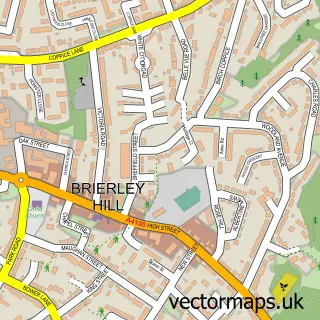
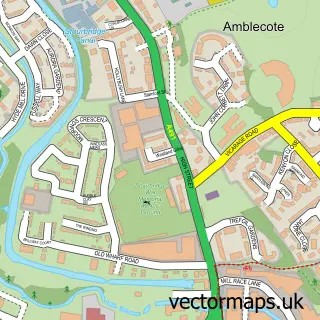
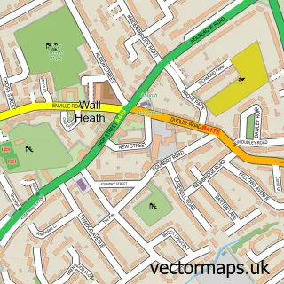
This Brierley Hill street map is a detailed vector street map covering a 750m x 750m area. Select a larger area to create and download your own vector street map of Brierley Hill.
The 750-metre map sample for Brierley Hill covers 282 mapped buildings and approximately 59.2 km of road detail, of which 39 named roads are named. The immediate area includes 1 GP surgery, with 17 within 2 miles, 5 pubs and 1 MOT station, with 71 within 2 miles. The wider area around Brierley Hill features 5 tourism points of interest, 17 food and drink venues and 1 hotel. To create a larger or custom map of Brierley Hill, the map builder lets you define your own coverage area and download editable SVG, PDF and PNG files.
Create a larger editable map of Brierley Hill
Choose any area you need and generate a high-quality vector map instantly. Perfect for print, planning, design, business and personal use.

This Brierley Hill street map in West Midlands is available as downloadable SVG, PDF and PNG map files, or as a printed map for planning, business, display, education, local information and design work. You can also create a larger custom map area using the map selector.
What this Brierley Hill map sample shows
Brierley Hill lies within Dudley District (B) parish, part of Netherton, Woodside And St Andrews ward in the Dudley District (B) local authority area. The postcode geography for this area includes the DY postcode area, the DY5 postcode district and the DY5 1 postcode sector. Residents fall under the Nhs Black Country Integrated Care Board for NHS services.
Local features near Brierley Hill
Within 2 milesAmenities and services in and around Brierley Hill.
Administrative and postcode information for Brierley Hill
The local authority covering Brierley Hill is Dudley District (B), within the county of West Midlands. The settlement lies within Netherton, Woodside And St Andrews ward and Dudley District (B) civil parish. The DY5 postcode district and DY5 1 postcode sector serve the immediate area. NHS provision in the area is delivered through The Dudley Group Nhs Foundation Trust.
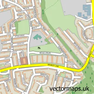
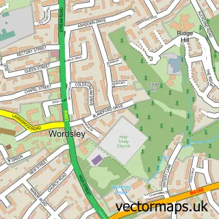
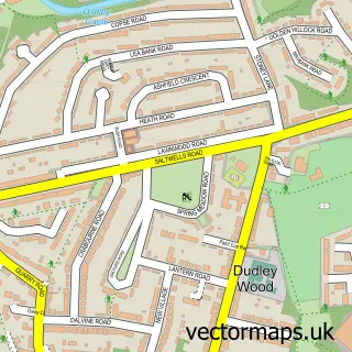
Nearby street map samples around Brierley Hill

More street maps in West Midlands
750 metre map area coverage
Boundary, postcode and point of interest information for the 750m x 750m rectangle centred on this sample map.
Boundaries containing map centre
Constituency: Stourbridge Boro Const
District: Dudley District (B)
Icb: NHS Black Country ICB
Police Force: west midlands
Postcode District: DY5
Postcode Sector: DY5 3
Ward: Brierley Hill & Wordsley South Ward
Nearby boundaries intersecting sample
Constituency: Dudley Boro Const
Postcode Sector: DY5 1, DY5 2
Ward: Brockmoor & Pensnett Ward
Postcode coverage
POI category counts
Beauty Salon: 9
Furniture Store: 9
Cafe: 7
Charity Organization: 7
Church Cathedral: 7
Dentist: 7
Gym: 7
Indian Restaurant: 7
Carpet Store: 6
Discount Store: 6
Sample points of interest
- JMC Accountants & Tax Advisers Ltd
- Acubal
- Tony Concannon
- Griff & Co
- Solved S E O
- Big Man's Food
- Admiral Casino: Brierley Hill
- Cashino Gaming
- St Michael
- Compton Hospice Shop
- Tenovus
- M V Global Interiors
Create a larger editable map of Brierley Hill
This sample shows only a 750 metre area. To create a larger map of Brierley Hill, use our map builder to choose your own coverage area, add titles and download editable SVG, PDF and PNG files.
Create a custom map of Brierley Hill