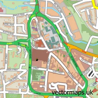
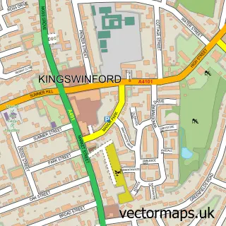
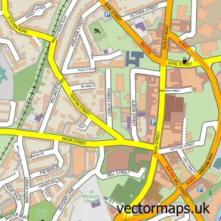
This Amblecote street map is a detailed vector street map covering a 750m x 750m area. Select a larger area to create and download your own vector street map of Amblecote.
The 750-metre map sample for Amblecote covers 415 mapped buildings and approximately 36.2 km of road detail, of which 26 named roads are named. The immediate area includes 1 GP surgery, with 12 within 2 miles, 1 pub and 1 MOT station, with 46 within 2 miles. The wider area around Amblecote features 3 tourism points of interest and 5 food and drink venues. To create a larger or custom map of Amblecote, the map builder lets you define your own coverage area and download editable SVG, PDF and PNG files.
Create a larger editable map of Amblecote
Choose any area you need and generate a high-quality vector map instantly. Perfect for print, planning, design, business and personal use.

This Amblecote street map in West Midlands is available as downloadable SVG, PDF and PNG map files, or as a printed map for planning, business, display, education, local information and design work. You can also create a larger custom map area using the map selector.
What this Amblecote map sample shows
Amblecote lies within Dudley District (B) parish, part of Amblecote ward in the Dudley District (B) local authority area. The postcode geography for this area includes the DY postcode area, the DY8 postcode district and the DY8 4 postcode sector. Residents fall under the Nhs Black Country Integrated Care Board for NHS services.
Local features near Amblecote
Within 2 milesAmenities and services in and around Amblecote.
Administrative and postcode information for Amblecote
The local authority covering Amblecote is Dudley District (B), within the county of West Midlands. The settlement lies within Amblecote ward and Dudley District (B) civil parish. The DY8 postcode district and DY8 4 postcode sector serve the immediate area. NHS provision in the area is delivered through The Dudley Group Nhs Foundation Trust.
Nearby street map samples around Amblecote


More street maps in West Midlands
750 metre map area coverage
Boundary, postcode and point of interest information for the 750m x 750m rectangle centred on this sample map.
Boundaries containing map centre
Constituency: Stourbridge Boro Const
District: Dudley District (B)
Icb: NHS Black Country ICB
Police Force: west midlands
Postcode District: DY8
Postcode Sector: DY8 4
Ward: Amblecote Ward
Nearby boundaries intersecting sample
Postcode Sector: DY8 1, DY8 3
Ward: Wollaston & Stourbridge Town Ward
Postcode coverage
POI category counts
Hospital: 4
Contractor: 3
Doctor: 3
Landmark And Historical Building: 3
Printing Services: 3
Assisted Living Facility: 2
Automotive Repair: 2
Bridal Shop: 2
Business Manufacturing And Supply: 2
Church Cathedral: 2
Sample points of interest
- STAC-Cricket
- B B Sign & Graphic
- JC Architectural Design
- Ruskin Glass Centre
- Hollybush House
- The Brambles
- Fieldings Auctioneers
- Black Country Hearing Services
- Vauxhall Stourbridge Motor House
- Crestwood Motors
- National Tyres and Autocare
- Cakes By Walshy
Create a larger editable map of Amblecote
This sample shows only a 750 metre area. To create a larger map of Amblecote, use our map builder to choose your own coverage area, add titles and download editable SVG, PDF and PNG files.
Create a custom map of Amblecote