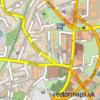
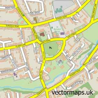
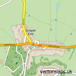
This Wall Heath street map is a detailed vector street map covering a 750m x 750m area. Select a larger area to create and download your own vector street map of Wall Heath.
The 750-metre map sample for Wall Heath covers 431 mapped buildings and approximately 58.3 km of road detail, of which 44 named roads are named. The immediate area includes 1 school, 5 GP surgeries within 2 miles, 5 pubs and 11 MOT stations within 2 miles. The wider area around Wall Heath features 2 tourism points of interest, 6 food and drink venues and 1 hotel. To create a larger or custom map of Wall Heath, the map builder lets you define your own coverage area and download editable SVG, PDF and PNG files.
Create a larger editable map of Wall Heath
Choose any area you need and generate a high-quality vector map instantly. Perfect for print, planning, design, business and personal use.

This Wall Heath street map in West Midlands is available as downloadable SVG, PDF and PNG map files, or as a printed map for planning, business, display, education, local information and design work. You can also create a larger custom map area using the map selector.
What this Wall Heath map sample shows
Wall Heath lies within Dudley District (B) parish, part of Kingswinford South ward in the Dudley District (B) local authority area. The postcode geography for this area includes the DY postcode area, the DY6 postcode district and the DY6 9 postcode sector. Residents fall under the Nhs Black Country Integrated Care Board for NHS services.
Local features near Wall Heath
Within 2 milesAmenities and services in and around Wall Heath.
Administrative and postcode information for Wall Heath
Wall Heath lies within Dudley District (B) parish, part of Kingswinford South ward in the Dudley District (B) local authority area. The postcode geography for this area includes the DY postcode area, the DY6 postcode district and the DY6 9 postcode sector. Residents fall under the Nhs Black Country Integrated Care Board for NHS services.
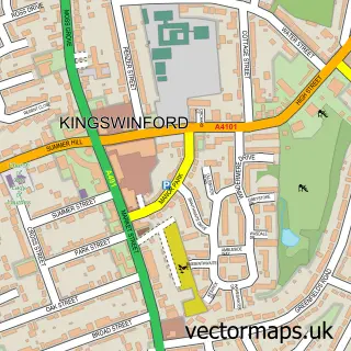
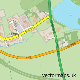
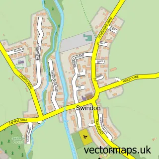
Nearby street map samples around Wall Heath

More street maps in West Midlands
750 metre map area coverage
Boundary, postcode and point of interest information for the 750m x 750m rectangle centred on this sample map.
Boundaries containing map centre
Constituency: Kingswinford and South Staffordshire Co Const
District: Dudley District (B)
Icb: NHS Black Country ICB
Police Force: west midlands
Postcode District: DY6
Postcode Sector: DY6 9
Ward: Kingswinford North & Wall Heath Ward
Nearby boundaries intersecting sample
Postcode Sector: DY6 0, DY6 7
Postcode coverage
POI category counts
Beauty Salon: 8
Hair Salon: 6
Pub: 5
Barber: 4
Beauty And Spa: 4
Post Office: 4
Professional Services: 4
Gas Station: 3
Grocery Store: 3
Podiatrist: 3
Sample points of interest
- Clover Accountancy
- 1st Wall Heath Scout Group
- 3sixty Creative Solutions Ltd
- Leighsa's Loft
- Highgate Common
- Midcounties Co-Op Wallheath, Wall Heath
- The Vibe Group LTD
- Jim'S Autos
- Poppy Doll
- Kirsty's Creative Cakes
- The Village Bakery
- BS1 Barbershop
Create a larger editable map of Wall Heath
This sample shows only a 750 metre area. To create a larger map of Wall Heath, use our map builder to choose your own coverage area, add titles and download editable SVG, PDF and PNG files.
Create a custom map of Wall Heath