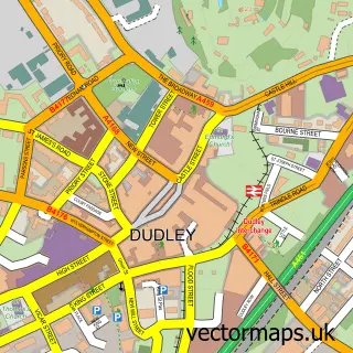
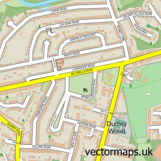
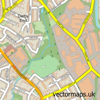
This Dixons Green street map is a detailed vector street map covering a 750m x 750m area. Select a larger area to create and download your own vector street map of Dixons Green.
The 750-metre map sample for Dixons Green covers 409 mapped buildings and approximately 66.0 km of road detail, of which 57 named roads are named. The immediate area includes 1 school, 1 GP surgery, with 14 within 2 miles and 39 MOT stations within 2 miles. The wider area around Dixons Green features 1 hotel. To create a larger or custom map of Dixons Green, the map builder lets you define your own coverage area and download editable SVG, PDF and PNG files.
Create a larger editable map of Dixons Green
Choose any area you need and generate a high-quality vector map instantly. Perfect for print, planning, design, business and personal use.

This Dixons Green street map in West Midlands is available as downloadable SVG, PDF and PNG map files, or as a printed map for planning, business, display, education, local information and design work. You can also create a larger custom map area using the map selector.
What this Dixons Green map sample shows
Dixons Green lies within Dudley District (B) parish, part of Castle And Priory ward in the Dudley District (B) local authority area. The postcode geography for this area includes the DY postcode area, the DY1 postcode district and the DY1 4 postcode sector. Residents fall under the Nhs Black Country Integrated Care Board for NHS services.
Local features near Dixons Green
Within 2 milesAmenities and services in and around Dixons Green.
Administrative and postcode information for Dixons Green
The local authority covering Dixons Green is Dudley District (B), within the county of West Midlands. The settlement lies within Castle And Priory ward and Dudley District (B) civil parish. The DY1 postcode district and DY1 4 postcode sector serve the immediate area. NHS provision in the area is delivered through The Dudley Group Nhs Foundation Trust.
Nearby street map samples around Dixons Green


More street maps in West Midlands
750 metre map area coverage
Boundary, postcode and point of interest information for the 750m x 750m rectangle centred on this sample map.
Boundaries containing map centre
Constituency: Dudley Boro Const
District: Dudley District (B)
Icb: NHS Black Country ICB
Police Force: west midlands
Postcode District: DY2
Postcode Sector: DY2 7
Ward: St. Thomas's Ward
Nearby boundaries intersecting sample
Postcode Sector: DY2 8
Postcode coverage
POI category counts
Professional Services: 6
Convenience Store: 5
Gas Station: 4
Business Management Services: 3
Land Surveying: 3
Package Locker: 3
Shipping Center: 3
Accountant: 2
Airport Terminal: 2
Beauty Salon: 2
Sample points of interest
- Blake & Co.
- Neil Westwood and Co
- Ark Studios
- R H Travels
- R H Travels
- Dixon's Green Service Station (Park Garage Group)
- Melford Electricians
- Y&A Car Hire LTD
- Marmaris barbershop
- Purity Clinic
- Tranquil Escapes
- Bowles Whittick Young
Create a larger editable map of Dixons Green
This sample shows only a 750 metre area. To create a larger map of Dixons Green, use our map builder to choose your own coverage area, add titles and download editable SVG, PDF and PNG files.
Create a custom map of Dixons Green