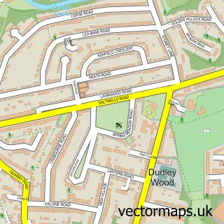
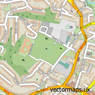
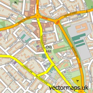
This Rowley Regis street map is a detailed vector street map covering a 750m x 750m area. Select a larger area to create and download your own vector street map of Rowley Regis.
The 750-metre map sample for Rowley Regis covers 378 mapped buildings and approximately 46.7 km of road detail, of which 35 named roads are named. The immediate area includes 14 GP surgeries within 2 miles, 1 pub and 1 MOT station, with 59 within 2 miles. The wider area around Rowley Regis features 1 tourism point of interest and 2 food and drink venues. To create a larger or custom map of Rowley Regis, the map builder lets you define your own coverage area and download editable SVG, PDF and PNG files.
Create a larger editable map of Rowley Regis
Choose any area you need and generate a high-quality vector map instantly. Perfect for print, planning, design, business and personal use.

This Rowley Regis street map in West Midlands is available as downloadable SVG, PDF and PNG map files, or as a printed map for planning, business, display, education, local information and design work. You can also create a larger custom map area using the map selector.
What this Rowley Regis map sample shows
Rowley Regis lies within Sandwell District (B) parish, part of Blackheath ward in the Sandwell District (B) local authority area. The postcode geography for this area includes the B postcode area, the B65 postcode district and the B65 0 postcode sector. Residents fall under the Nhs Black Country Integrated Care Board for NHS services.
Local features near Rowley Regis
Within 2 milesAmenities and services in and around Rowley Regis.
Administrative and postcode information for Rowley Regis
Rowley Regis lies within Sandwell District (B) parish, part of Blackheath ward in the Sandwell District (B) local authority area. The postcode geography for this area includes the B postcode area, the B65 postcode district and the B65 0 postcode sector. Residents fall under the Nhs Black Country Integrated Care Board for NHS services.
Nearby street map samples around Rowley Regis


More street maps in West Midlands
750 metre map area coverage
Boundary, postcode and point of interest information for the 750m x 750m rectangle centred on this sample map.
Boundaries containing map centre
Constituency: West Bromwich Boro Const
District: Sandwell District (B)
Icb: NHS Black Country ICB
Police Force: west midlands
Postcode District: B64
Postcode Sector: B64 5
Ward: Rowley Ward
Nearby boundaries intersecting sample
Constituency: Halesowen Boro Const, Stourbridge Boro Const
District: Dudley District (B)
Postcode District: B65, DY2
Postcode Sector: B65 8, DY2 9
Ward: Netherton & Holly Hall Ward, Quarry Bank & Dudley Wood Ward
Postcode coverage
POI category counts
Automotive Repair: 6
Professional Services: 5
Business Manufacturing And Supply: 4
Furniture Store: 4
Contractor: 3
Convenience Store: 3
Metal Supplier: 3
Retail: 3
Appliance Manufacturer: 2
Auto Detailing: 2
Sample points of interest
- Advanced Joinery Services
- West Midland Loose Leaf Co
- PayPoint
- Hingley Playing Fields
- Jon Crump Restorations
- DC Customs
- Old Moot Meet Car Wash
- DC Customs
- A H Furnishings
- Steves Auto Services
- Audenshaws
- micro campers for sale
Create a larger editable map of Rowley Regis
This sample shows only a 750 metre area. To create a larger map of Rowley Regis, use our map builder to choose your own coverage area, add titles and download editable SVG, PDF and PNG files.
Create a custom map of Rowley Regis