Vector Maps logo
Home Why it works Popular maps Districts Samples Customizer Create Your Map
VectorMaps.uk
Home Popular maps Districts Samples Customizer Create Your Map Privacy Disclaimer
Home / UK Maps / Ross and Cromarty / Broadford Map

This Broadford street map is a detailed vector street map covering a 750m x 750m area. Select a larger area to create and download your own vector street map of Broadford.

Broadford is a village in Ross And Cromarty, in the Highlands And Islands of Scotland. Historically, the area formed part of Inverness-Shire. The settlement falls within the Ross, Skye And Lochaber parliamentary constituency. It is served by the IV49 post

The 750-metre map sample for Broadford covers 88 mapped buildings and approximately 9.1 km of road detail, of which 8 named roads are named. The immediate area includes 1 GP surgery within 2 miles and 1 MOT station, with 2 within 2 miles. The wider area around Broadford features 2 food and drink venues and 5 hotels. To create a larger or custom map of Broadford, the map builder lets you define your own coverage area and download editable SVG, PDF and PNG files.

88Buildings
9.13 kmRoads
8Named roads
0Residents within 2 miles
Create your own

Create a larger editable map of Broadford

Choose any area you need and generate a high-quality vector map instantly. Perfect for print, planning, design, business and personal use.

Choose any location
Editable SVG files
Any size up to A0
PDF, PNG & more
Instant download
High quality guaranteed
Create My Custom Map
Secure, private & no credit card required
Broadford Vector Street Map
750m Sample
Broadford vector street map sample showing roads, buildings and local features in a 750 metre preview area
Buy Broadford Map Print from £12.95 Buy Broadford Digital Map from £6

This Broadford street map in Ross and Cromarty is available as downloadable SVG, PDF and PNG map files, or as a printed map for planning, business, display, education, local information and design work. You can also create a larger custom map area using the map selector.

What this Broadford map sample shows

Broadford lies within Highland parish, part of Eilean A Cheo ward in the Highland local authority area. The postcode geography for this area includes the IV postcode area, the IV49 postcode district and the IV49 9 postcode sector. Residents fall under the Highland for NHS services.

Local features near Broadford

Within 2 miles

Amenities and services in and around Broadford.

1 GP surgeries within 2 miles
1 MOT stations 2 within 2 miles
2 Food & drink
5 Hotels
1 Healthcare POIs
3 Vehicle services

Counts are approximate and based on publicly available data.

Administrative and postcode information for Broadford

The local authority covering Broadford is Highland, within the county of Ross And Cromarty. The settlement lies within Eilean A Cheo ward and Highland civil parish. The IV49 postcode district and IV49 9 postcode sector serve the immediate area. NHS provision in the area is delivered through Highland.

Parish HIGHLAND
Ward Eilean a Cheo
District / local authority Highland
County Ross and Cromarty
Historic county Inverness-shire
Postcode district IV49
Postcode sector IV49 9
Parliamentary constituency Ross, Skye and Lochaber
Region Highlands and Islands
Country Scotland

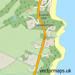
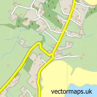
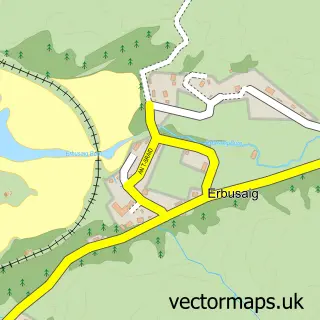
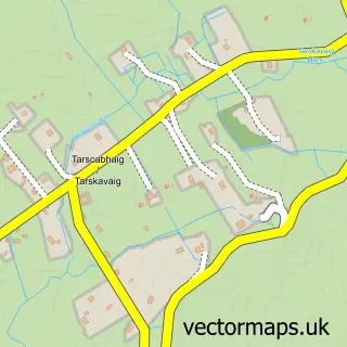
Nearby street map samples around Broadford

Street map sample of Portree, Ross and Cromarty Portree Town - Ross and Cromarty - 16.0 miles Street map sample of Inverness, Inverness Inverness City - Inverness - 64.7 miles Street map sample of Breakish, Ross and Cromarty Breakish Village - Ross and Cromarty - 2.3 miles Street map sample of Torrin, Ross and Cromarty Torrin Village - Ross and Cromarty - 4.4 miles Street map sample of Kyleakin, Ross and Cromarty Kyleakin Village - Ross and Cromarty - 6.9 miles Street map sample of Duisdeil Mòr, Ross and Cromarty Duisdeil Mòr Village - Ross and Cromarty - 7.2 miles Street map sample of Kyle of Lochalsh, Ross and Cromarty Kyle of Lochalsh Village - Ross and Cromarty - 7.7 miles Street map sample of Camas Cros, Ross and Cromarty Camas Cros Village - Ross and Cromarty - 8.0 miles Street map sample of Erbusaig, Ross and Cromarty Erbusaig Village - Ross and Cromarty - 8.3 miles Street map sample of Tarsgabhaig, Ross and Cromarty Tarsgabhaig Village - Ross and Cromarty - 9.0 miles

More street maps in Ross and Cromarty

Street map sample of Breakish, Ross and Cromarty Breakish Village - 2.3 miles Street map sample of Torrin, Ross and Cromarty Torrin Village - 4.4 miles Street map sample of Kyleakin, Ross and Cromarty Kyleakin Village - 6.9 miles Street map sample of Duisdeil Mòr, Ross and Cromarty Duisdeil Mòr Village - 7.2 miles Street map sample of Kyle of Lochalsh, Ross and Cromarty Kyle of Lochalsh Village - 7.7 miles

750 metre map area coverage

Boundary, postcode and point of interest information for the 750m x 750m rectangle centred on this sample map.

Boundaries containing map centre

Constituency: Inverness, Skye and West Ross-shire Co Const

District: Highland

Icb: Highland

Postcode District: IV49

Postcode Sector: IV49 9

Ward: Eilean a' Cheo Ward

Nearby boundaries intersecting sample

No additional intersecting boundaries found.

Postcode coverage

IV49 IV49 9

POI category counts

Hotel: 5

Bed And Breakfast: 4

Flowers And Gifts Shop: 4

Convenience Store: 3

Grocery Store: 3

Jewelry Store: 3

Bar: 2

Gas Station: 2

Restaurant: 2

Antique Store: 1

Sample points of interest

  • Skye Antiques Antique Store
  • Handspinner Having Fun Arts And Crafts
  • The Cooperative Food (BF) Broadford (ERF), Broadford Atms
  • Bank of Scotland Banks
  • Crowlin Bar Bar
  • Gabbro Bar Bar
  • Bayside House B&B Bed And Breakfast
  • Broadford House B&B Bed And Breakfast
  • Limestone Cottage Bed And Breakfast
  • Smiddy Croft Accommodation Bed And Breakfast
  • Jewson Building Supply Store
  • Strath & Sleat Catholic Church

Create a larger editable map of Broadford

This sample shows only a 750 metre area. To create a larger map of Broadford, use our map builder to choose your own coverage area, add titles and download editable SVG, PDF and PNG files.

Create a custom map of Broadford

Phone 01751 473136 | Copyright Vectormaps.uk 2026

Samples Customizer Privacy Disclaimer
Broadford Vector Street Map
Broadford enlarged street map sample showing a 750 metre preview area