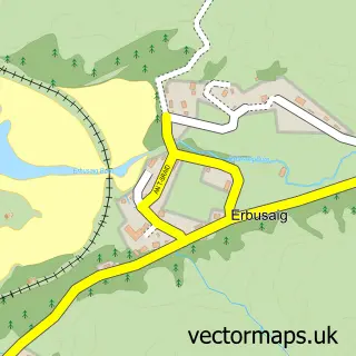
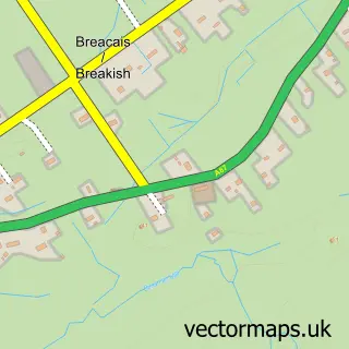
This Kyleakin street map is a detailed vector street map covering a 750m x 750m area. Select a larger area to create and download your own vector street map of Kyleakin.
The 750-metre map sample for Kyleakin covers 59 mapped buildings and approximately 5.4 km of road detail, of which 6 named roads are named. The immediate area includes 1 GP surgery within 2 miles, 1 pub and 2 MOT stations within 2 miles. The wider area around Kyleakin features 2 tourism points of interest, 4 food and drink venues and 3 hotels. To create a larger or custom map of Kyleakin, the map builder lets you define your own coverage area and download editable SVG, PDF and PNG files.
Create a larger editable map of Kyleakin
Choose any area you need and generate a high-quality vector map instantly. Perfect for print, planning, design, business and personal use.

This Kyleakin street map in Ross and Cromarty is available as downloadable SVG, PDF and PNG map files, or as a printed map for planning, business, display, education, local information and design work. You can also create a larger custom map area using the map selector.
What this Kyleakin map sample shows
Kyleakin lies within Highland parish, part of Eilean A Cheo ward in the Highland local authority area. The postcode geography for this area includes the IV postcode area, the IV41 postcode district and the IV41 8 postcode sector. Residents fall under the Highland for NHS services.
Local features near Kyleakin
Within 2 milesAmenities and services in and around Kyleakin.
Administrative and postcode information for Kyleakin
The local authority covering Kyleakin is Highland, within the county of Ross And Cromarty. The settlement lies within Eilean A Cheo ward and Highland civil parish. The IV41 postcode district and IV41 8 postcode sector serve the immediate area. NHS provision in the area is delivered through Highland.
Nearby street map samples around Kyleakin


More street maps in Ross and Cromarty
750 metre map area coverage
Boundary, postcode and point of interest information for the 750m x 750m rectangle centred on this sample map.
Boundaries containing map centre
Constituency: Inverness, Skye and West Ross-shire Co Const
District: Highland
Icb: Highland
Postcode District: IV41
Postcode Sector: IV41 8
Ward: Eilean a' Cheo Ward
Nearby boundaries intersecting sample
No additional intersecting boundaries found.
Postcode coverage
POI category counts
Bed And Breakfast: 8
Hotel: 3
Community Services Non Profits: 2
Landmark And Historical Building: 2
Restaurant: 2
Accommodation: 1
Armed Forces Branch: 1
Bar: 1
Bridge: 1
Cafe: 1
Sample points of interest
- Hillside
- Kyleakin War Memorial
- Saucy Mary's Village Shop
- Cliffe House
- Fir Chlis
- Glenarroch
- Hillside
- Mrs E MacLennan
- Rainbow View
- White Heather Hotel
- Winklebeech B&B
- Old Bridge At Sligachan
Create a larger editable map of Kyleakin
This sample shows only a 750 metre area. To create a larger map of Kyleakin, use our map builder to choose your own coverage area, add titles and download editable SVG, PDF and PNG files.
Create a custom map of Kyleakin