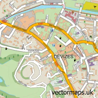
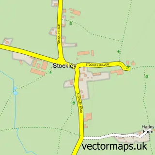
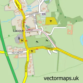
This Bromham street map is a detailed vector street map covering a 750m x 750m area. Select a larger area to create and download your own vector street map of Bromham.
The 750-metre map sample for Bromham covers 158 mapped buildings and approximately 6.1 km of road detail, of which 10 named roads are named. The immediate area includes 1 school, 1 pub and 1 MOT station within 2 miles. The wider area around Bromham features 1 food and drink venue. To create a larger or custom map of Bromham, the map builder lets you define your own coverage area and download editable SVG, PDF and PNG files.
Create a larger editable map of Bromham
Choose any area you need and generate a high-quality vector map instantly. Perfect for print, planning, design, business and personal use.

This Bromham street map in Wiltshire is available as downloadable SVG, PDF and PNG map files, or as a printed map for planning, business, display, education, local information and design work. You can also create a larger custom map area using the map selector.
What this Bromham map sample shows
Bromham lies within Bromham Cp parish, part of Bromham, Rowde And Potterne ward in the Wiltshire local authority area. The postcode geography for this area includes the SN postcode area, the SN15 postcode district and the SN15 2 postcode sector. Residents fall under the Nhs Bath And North East Somerset, Swindon And Wiltshire Integrated Care Board for NHS services.
Local features near Bromham
Within 2 milesAmenities and services in and around Bromham.
Administrative and postcode information for Bromham
Bromham lies within Bromham Cp parish, part of Bromham, Rowde And Potterne ward in the Wiltshire local authority area. The postcode geography for this area includes the SN postcode area, the SN15 postcode district and the SN15 2 postcode sector. Residents fall under the Nhs Bath And North East Somerset, Swindon And Wiltshire Integrated Care Board for NHS services.
Nearby street map samples around Bromham

More street maps in Wiltshire
750 metre map area coverage
Boundary, postcode and point of interest information for the 750m x 750m rectangle centred on this sample map.
Boundaries containing map centre
Constituency: Melksham and Devizes Co Const
District: Wiltshire
Icb: NHS Bath and North East Somerset Swindon and Wiltshire ICB
Parish: Bromham CP
Police Force: wiltshire
Postcode District: SN15
Postcode Sector: SN15 2
Nearby boundaries intersecting sample
No additional intersecting boundaries found.
Postcode coverage
POI category counts
Elementary School: 2
Furniture Store: 2
Pet Store: 2
Anglican Church: 1
Arts And Crafts: 1
Butcher Shop: 1
Carpenter: 1
Child Care And Day Care: 1
Construction Services: 1
Electrician: 1
Sample points of interest
- Bromham: St Nicholas
- The Patchwork Rabbit
- H F Stiles & Son
- Guy Morse-Brown Hat Blocks
- Busy Kids
- WAK Groundworks and Civils
- Oliver's electrical
- Bromham St Nicholas C of E School
- St Nicholas Primary School, Bromham
- Olives 'N' Stuff
- Golden Gate Financial Planning and Wealth Management
- Mark Wilkinson Furniture
Create a larger editable map of Bromham
This sample shows only a 750 metre area. To create a larger map of Bromham, use our map builder to choose your own coverage area, add titles and download editable SVG, PDF and PNG files.
Create a custom map of Bromham