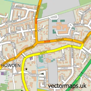
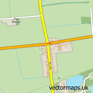
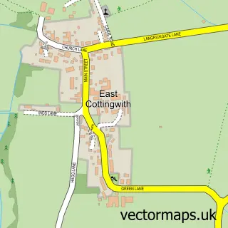
This Bubwith street map is a detailed vector street map covering a 750m x 750m area. Select a larger area to create and download your own vector street map of Bubwith.
The 750-metre map sample for Bubwith covers 258 mapped buildings and approximately 9.3 km of road detail, of which 16 named roads are named. The immediate area includes 1 school, 1 pub and 1 MOT station within 2 miles. The wider area around Bubwith features 1 food and drink venue. To create a larger or custom map of Bubwith, the map builder lets you define your own coverage area and download editable SVG, PDF and PNG files.
Create a larger editable map of Bubwith
Choose any area you need and generate a high-quality vector map instantly. Perfect for print, planning, design, business and personal use.

This Bubwith street map in East Riding of Yorkshire is available as downloadable SVG, PDF and PNG map files, or as a printed map for planning, business, display, education, local information and design work. You can also create a larger custom map area using the map selector.
What this Bubwith map sample shows
Bubwith lies within Bubwith Cp parish, part of Howdenshire ward in the East Riding Of Yorkshire local authority area. The postcode geography for this area includes the YO postcode area, the YO8 postcode district and the YO8 6 postcode sector. Residents fall under the Nhs Humber And North Yorkshire Integrated Care Board for NHS services.
Local features near Bubwith
Within 2 milesAmenities and services in and around Bubwith.
Administrative and postcode information for Bubwith
Bubwith lies within Bubwith Cp parish, part of Howdenshire ward in the East Riding Of Yorkshire local authority area. The postcode geography for this area includes the YO postcode area, the YO8 postcode district and the YO8 6 postcode sector. Residents fall under the Nhs Humber And North Yorkshire Integrated Care Board for NHS services.
Nearby street map samples around Bubwith

More street maps in East Riding of Yorkshire
750 metre map area coverage
Boundary, postcode and point of interest information for the 750m x 750m rectangle centred on this sample map.
Boundaries containing map centre
Constituency: Goole and Pocklington Co Const
District: East Riding of Yorkshire
Icb: NHS Humber and North Yorkshire ICB
Parish: Bubwith CP
Police Force: humberside
Postcode District: YO8
Postcode Sector: YO8 6
Ward: Howdenshire Ward
Nearby boundaries intersecting sample
Constituency: Selby Co Const
District: North Yorkshire
Parish: North Duffield CP
Police Force: north yorkshire
Postcode Sector: YO8 5
Postcode coverage
POI category counts
Convenience Store: 3
Beauty Salon: 2
Butcher Shop: 2
Korean Grocery Store: 2
Antique Store: 1
Atms: 1
Building Supply Store: 1
Church Cathedral: 1
Cleaning Services: 1
Contractor: 1
Sample points of interest
- 19th Century Antiques
- Morrisons Daily - Selby Bubwith Main Street, Bubwith
- Beauty By Jessica
- Finesse Hair Studio
- David Mason Jacksons Floors
- J a Mounfield & Son
- Mounfield Butchers
- All Saint's Church Bubwith
- Hygieia Group Ltd.
- Boss Design & Build
- McColl's
- Morrisons Daily
Create a larger editable map of Bubwith
This sample shows only a 750 metre area. To create a larger map of Bubwith, use our map builder to choose your own coverage area, add titles and download editable SVG, PDF and PNG files.
Create a custom map of Bubwith