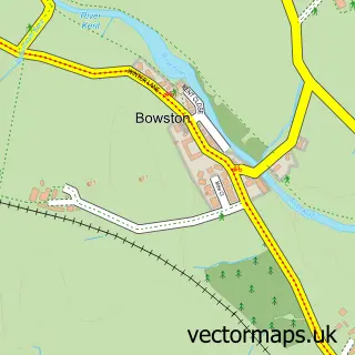
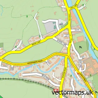
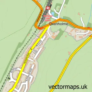
This Burneside street map is a detailed vector street map covering a 750m x 750m area. Select a larger area to create and download your own vector street map of Burneside.
The 750-metre map sample for Burneside covers 214 mapped buildings and approximately 13.6 km of road detail, of which 15 named roads are named. The immediate area includes 1 school, 1 railway station, 1 GP surgery within 2 miles and 18 MOT stations within 2 miles. The wider area around Burneside features 2 hotels and 2 campsites within 2 miles. To create a larger or custom map of Burneside, the map builder lets you define your own coverage area and download editable SVG, PDF and PNG files.
Create a larger editable map of Burneside
Choose any area you need and generate a high-quality vector map instantly. Perfect for print, planning, design, business and personal use.

This Burneside street map in Cumbria is available as downloadable SVG, PDF and PNG map files, or as a printed map for planning, business, display, education, local information and design work. You can also create a larger custom map area using the map selector.
What this Burneside map sample shows
Burneside lies within Strickland Ketel Cp parish, part of Kendal Rural ward in the Westmorland And Furness local authority area. The postcode geography for this area includes the LA postcode area, the LA9 postcode district and the LA9 6 postcode sector. Residents fall under the Nhs Lancashire And South Cumbria Integrated Care Board for NHS services.
Local features near Burneside
Within 2 milesAmenities and services in and around Burneside.
Administrative and postcode information for Burneside
Burneside lies within Strickland Ketel Cp parish, part of Kendal Rural ward in the Westmorland And Furness local authority area. The postcode geography for this area includes the LA postcode area, the LA9 postcode district and the LA9 6 postcode sector. Residents fall under the Nhs Lancashire And South Cumbria Integrated Care Board for NHS services.
Nearby street map samples around Burneside

More street maps in Cumbria
750 metre map area coverage
Boundary, postcode and point of interest information for the 750m x 750m rectangle centred on this sample map.
Boundaries containing map centre
Constituency: Westmorland and Lonsdale Co Const
District: Westmorland and Furness
Icb: NHS Lancashire and South Cumbria ICB
Parish: Strickland Ketel CP
Police Force: cumbria
Postcode District: LA9
Postcode Sector: LA9 6
Ward: Upper Kent Ward
Nearby boundaries intersecting sample
Parish: Strickland Roger CP
Postcode Sector: LA9 5
Postcode coverage
POI category counts
Professional Services: 3
Train Station: 3
Elementary School: 2
Hotel: 2
Package Locker: 2
Accommodation: 1
Agriculture: 1
Anglican Church: 1
Bakery: 1
Boat Parts And Supply Store: 1
Sample points of interest
- Tony & Caroline
- Kendal Christmas Trees
- St Oswald
- E & J G Seward bakers shop 6 steeles row
- Fyne Boat Kits
- Fyne Boat Kits
- Paul L Robinson
- A & S Luisi Joiners & Contractors
- Saint Oswald's Church Burneside
- The Bryce
- Burneside Cricket Club
- SWF Driving
Create a larger editable map of Burneside
This sample shows only a 750 metre area. To create a larger map of Burneside, use our map builder to choose your own coverage area, add titles and download editable SVG, PDF and PNG files.
Create a custom map of Burneside