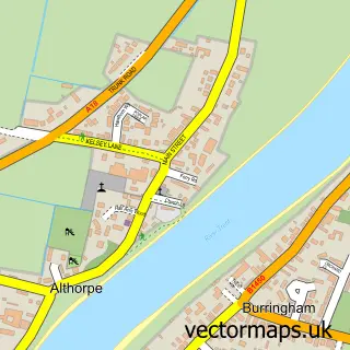
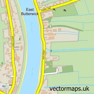
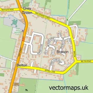
This Burringham street map is a detailed vector street map covering a 750m x 750m area. Select a larger area to create and download your own vector street map of Burringham.
The 750-metre map sample for Burringham covers 289 mapped buildings and approximately 11.2 km of road detail, of which 16 named roads are named. The immediate area includes 1 pub and 3 MOT stations within 2 miles. The wider area around Burringham features 1 tourism point of interest, 1 food and drink venue and 1 hotel. To create a larger or custom map of Burringham, the map builder lets you define your own coverage area and download editable SVG, PDF and PNG files.
Create a larger editable map of Burringham
Choose any area you need and generate a high-quality vector map instantly. Perfect for print, planning, design, business and personal use.

This Burringham street map in Lincolnshire is available as downloadable SVG, PDF and PNG map files, or as a printed map for planning, business, display, education, local information and design work. You can also create a larger custom map area using the map selector.
What this Burringham map sample shows
Burringham lies within Burringham Cp parish, part of Burringham And Gunness ward in the North Lincolnshire (B) local authority area. The postcode geography for this area includes the DN postcode area, the DN17 postcode district and the DN17 3 postcode sector. Residents fall under the Nhs Humber And North Yorkshire Integrated Care Board for NHS services.
Local features near Burringham
Within 2 milesAmenities and services in and around Burringham.
Administrative and postcode information for Burringham
Burringham lies within Burringham Cp parish, part of Burringham And Gunness ward in the North Lincolnshire (B) local authority area. The postcode geography for this area includes the DN postcode area, the DN17 postcode district and the DN17 3 postcode sector. Residents fall under the Nhs Humber And North Yorkshire Integrated Care Board for NHS services.
Nearby street map samples around Burringham

More street maps in Lincolnshire
750 metre map area coverage
Boundary, postcode and point of interest information for the 750m x 750m rectangle centred on this sample map.
Boundaries containing map centre
Constituency: Scunthorpe Co Const
District: North Lincolnshire (B)
Icb: NHS Humber and North Yorkshire ICB
Parish: Burringham CP
Police Force: humberside
Postcode District: DN17
Postcode Sector: DN17 3
Ward: Burringham & Gunness Ward
Nearby boundaries intersecting sample
Constituency: Doncaster East and the Isle of Axholme Co Const
Parish: Keadby with Althorpe CP
Ward: Axholme North Ward
Postcode coverage
POI category counts
Church Cathedral: 2
Contractor: 2
Grocery Store: 2
Post Office: 2
Anglican Church: 1
Community Center: 1
Dance Club: 1
Driving School: 1
Hair Salon: 1
Home Service: 1
Sample points of interest
- St Oswald's Althorpe
- Althorpe Methodist Church
- St John the Baptist's Church
- Burringham Village Hall
- Isle Construction
- Isle Construction
- Champagne Disco's
- Driver Education Services
- Burringham village store
- Co-op Food
- Scissor Sisters
- Ohana Childcare
Create a larger editable map of Burringham
This sample shows only a 750 metre area. To create a larger map of Burringham, use our map builder to choose your own coverage area, add titles and download editable SVG, PDF and PNG files.
Create a custom map of Burringham