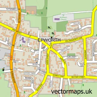
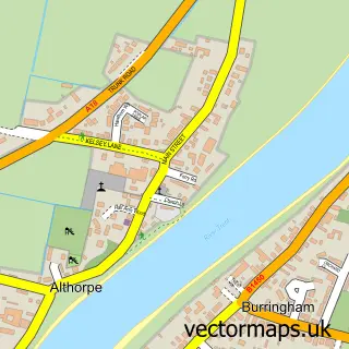
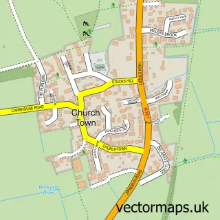
This West Butterwick street map is a detailed vector street map covering a 750m x 750m area. Select a larger area to create and download your own vector street map of West Butterwick.
The 750-metre map sample for West Butterwick covers 217 mapped buildings and approximately 12.2 km of road detail, of which 11 named roads are named. The immediate area includes 1 school and 2 pubs. The wider area around West Butterwick features 2 food and drink venues. To create a larger or custom map of West Butterwick, the map builder lets you define your own coverage area and download editable SVG, PDF and PNG files.
Create a larger editable map of West Butterwick
Choose any area you need and generate a high-quality vector map instantly. Perfect for print, planning, design, business and personal use.

This West Butterwick street map in Lincolnshire is available as downloadable SVG, PDF and PNG map files, or as a printed map for planning, business, display, education, local information and design work. You can also create a larger custom map area using the map selector.
What this West Butterwick map sample shows
West Butterwick lies within East Butterwick Cp parish, part of Ridge ward in the North Lincolnshire (B) local authority area. The postcode geography for this area includes the DN postcode area, the DN17 postcode district and the DN17 3 postcode sector. Residents fall under the Nhs Humber And North Yorkshire Integrated Care Board for NHS services.
Local features near West Butterwick
Within 2 milesAmenities and services in and around West Butterwick.
Administrative and postcode information for West Butterwick
The local authority covering West Butterwick is North Lincolnshire (B), within the county of Lincolnshire. The settlement lies within Ridge ward and East Butterwick Cp civil parish. The DN17 postcode district and DN17 3 postcode sector serve the immediate area. NHS provision in the area is delivered through Northern Lincolnshire And Goole Nhs Foundation Trust.
Nearby street map samples around West Butterwick

More street maps in Lincolnshire
750 metre map area coverage
Boundary, postcode and point of interest information for the 750m x 750m rectangle centred on this sample map.
Boundaries containing map centre
Constituency: Doncaster East and the Isle of Axholme Co Const
District: North Lincolnshire (B)
Icb: NHS Humber and North Yorkshire ICB
Parish: West Butterwick CP
Police Force: humberside
Postcode District: DN17
Postcode Sector: DN17 3
Ward: Axholme South Ward
Nearby boundaries intersecting sample
Constituency: Scunthorpe Co Const
Parish: East Butterwick CP
Ward: Messingham Ward
Postcode coverage
POI category counts
Anglican Church: 2
Church Cathedral: 2
Mortgage Broker: 2
Pub: 2
Automotive Storage Facility: 1
Bar: 1
Bookstore: 1
Bridal Shop: 1
Building Supply Store: 1
Doctor: 1
Sample points of interest
- St Andrew
- St Mary the Virgin
- Bad Monkey Conversions
- Ferry Boat Inn & Grill
- Munnbooks
- Made By Debbie Howe
- Stylux Blinds
- St Mary's Church
- West Butterwick Methodist Church
- Jubilee Branch Surgery
- West Butterwick C of E Primary School
- Axgro Foods
Create a larger editable map of West Butterwick
This sample shows only a 750 metre area. To create a larger map of West Butterwick, use our map builder to choose your own coverage area, add titles and download editable SVG, PDF and PNG files.
Create a custom map of West Butterwick